Margraten (village)

Margraten (village)

50°49′17″N 5°49′17″E / 50.82139, 5.82139

Margraten
Administration
Pays Drapeau : Pays-Bas Pays-Bas
Province Limbourg
Commune Eijsden-Margraten
Géographie
Population 3 360 hab. (2005)
Autres informations
Code postal 6269

Margraten (en limbourgeois Mergroate) est un village néerlandais situé dans la commune d'Eijsden-Margraten, dans la province du Limbourg néerlandais. Le 1er janvier 2005, le village comptait 3 360 habitants.

Petite commune indépendante jusqu'en 1982, Margraten devient le centre d'une grande commune nommée Margraten de 1982 à 2011. Depuis le 1er janvier 2011, le village fait partie de la commune d'Eijsden-Margraten.

Histoire

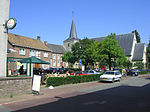
Place de l'Église Sainte Marguerite

L'église Sainte-Marguerite (en néerlandais: Sint Margaritakerk) date des XIV et XVème siècles. Le chœur de l'église a subi des restaurations qui ont été réalisées par l'architecte Alphons Boosten en 1922-1928.

Le cimetière américain des Pays-Bas où reposent 8 301 soldats américains ayant combattu pendant la seconde guerre mondiale se situe à Margraten.

Liens externes


Wikimedia Foundation. 2010.

Contenu soumis à la licence CC-BY-SA. Source : Article Margraten (village) de Wikipédia en français (auteurs)

Игры ⚽ Поможем решить контрольную работу

Regardez d'autres dictionnaires:

  • Margraten — Cette page d’homonymie répertorie les différents sujets et articles partageant un même nom. Toponymie Margraten (commune), commune néerlandaise de la province de Limbourg Margraten (village), chef lieu de cette commune Ce document provient de «… …   Wikipédia en Français

  • Margraten (commune) — Cet article concerne la commune. Pour la localité, voir Margraten (village). Margraten …   Wikipédia en Français

  • Berg (Margraten) — Berg is a hamlet in the Dutch province of Limburg. It is located in the municipality of Margraten VUGA s Alfabetische Plaatsnamengids van Nederland (13th edition), VUGA, 1997.] , on the road between Maastricht and Margraten. ANWB Topografische… …   Wikipedia

  • Eijsden — 50°46′43″N 5°42′33″E / 50.77861, 5.70917 …   Wikipédia en Français

  • Municipalities of Limburg (Netherlands) — This article gives a list of current and former municipalities of the Dutch province of Limburg. Position of Limburg within the Netherlands. Table of current municipalities Municipality / …   Wikipedia

  • Oost-Maarland — 50°47′41″N 5°42′47″E / 50.79472, 5.71306 …   Wikipédia en Français

  • Bemelen — 50°50′50″N 5°45′50″E / 50.84722, 5.76389 …   Wikipédia en Français

  • Cadier en Keer — 50°49′42″N 5°46′4″E / 50.82833, 5.76778 …   Wikipédia en Français

  • Mesch — 50°45′47″N 5°43′58″E / 50.76306, 5.73278 …   Wikipédia en Français

  • Mheer — 50°46′58″N 5°47′35″E / 50.78278, 5.79306 …   Wikipédia en Français

Share the article and excerpts

Direct link
Do a right-click on the link above
and select “Copy Link”