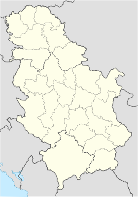
Lopatnica
- Lopatnica
-
Lopatnica (en serbe cyrillique : Лопатница) est un village de Serbie situé sur le territoire de la Ville de Kraljevo, district de Raška. En 2002, il comptait 303 habitants[1], dont une majorité de Serbes.
Démographie
Évolution historique de la population
Évolution démographique
| 1948 |
1953 |
1961 |
1971 |
1981 |
1991 |
2002 |
| 635 |
652 |
652 |
539 |
478 |
372 |
303[1] |
Répartition de la population (2002)
Notes de l'article
- ↑ a et b (sr) Livre 9, Population, analyse comparative de la population en 1948, 1953, 1961, 1971, 1981, 1991 et 2002, données par localités, Institut de statistique de la République de Serbie, Belgrade, mai 2004 (ISBN 86-84433-14-9)
- ↑ (sr) Livre 1, Population, origine nationale ou ethnique, données par localités, Institut de statistique de la République de Serbie, Belgrade, février 2003 (ISBN 86-84433-00-9)
Voir aussi
Articles connexes
Liens externes
Wikimedia Foundation.
2010.
Contenu soumis à la licence CC-BY-SA. Source : Article Lopatnica de Wikipédia en français (auteurs)
Regardez d'autres dictionnaires:
Guest House Lopatnica — (Lopatnica,Сербия) Категория отеля: 3 звездочный отель Адрес: Lopatnica 47, 36 … Каталог отелей
Kraljevo — Pour les articles homonymes, voir Kraljevo (homonymie). Kraljevo Краљево … Wikipédia en Français
Country house Milojević — (Lopatnica,Сербия) Категория отеля: 3 звездочный отель Адрес: Lopatnica 42A … Каталог отелей
Kraljevo — Infobox Settlement bgcolor= #BBDDFF name = Kraljevo official name = City of Kraljevo other name = Kraljevo native name = Краљево nickname = motto = Nama dobro, a nikome zlo. imagesize = 240px image caption = Monument to the serbian soldiers… … Wikipedia
Ibar River — Infobox River | river name = Ibar caption = Drainage basin of West Morava (Ibar west of Kos. Mitrovica) origin = Hajla mountain, eastern Montenegro mouth = into West Morava at Kraljevo basin countries = Serbia, Montenegro, length = 276 km… … Wikipedia
List of cities, towns and villages in Serbia — This is the complete list of settlements in Serbia without Kosovo, as recorded by 2002 census, sorted by municipalities. Settlements denoted as urban (towns and cities) are marked bold. Population for every settlement is given in brackets. The… … Wikipedia
List of settlements in Serbia (alphabetic) — This is the complete list of settlements in Serbia without Kosovo, as recorded by 2002 census, in alphabetic order. Settlements denoted as urban (towns and cities) are marked bold. Population for every settlement is given in brackets. The same… … Wikipedia
Adrani — Адрани Administration Pays Serbie … Wikipédia en Français
Bapsko Polje — Вапско Поље Administration Pays Serbie … Wikipédia en Français
Bare (Kraljevo) — Pour les articles homonymes, voir Bare. Bare Варе Administration Pays … Wikipédia en Français
 Serbie
