Lohsa

Lohsa

51° 23′ 03″ N 14° 24′ 13″ E / 51.3842, 14.4036

Lohsa
Image illustrative de l'article Lohsa
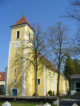
Vue de l'église de Lohsa
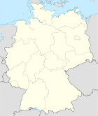
Blason de Lohsa
Germany location map.svg
Lohsa
Administration
Toponyme officiel
Pays Drapeau d'Allemagne Allemagne
Land Drapeau du Land de Saxe Saxe
District
(Regierungsbezirk)
district de Dresde
Arrondissement
(Landkreis)
Arrondissement de Bautzen
Code communal
(Gemeindeschlüssel)
Code postal
Indicatif téléphonique
Immatriculation
Politique
Bourgmestre
(Bürgermeister)
Partis au pouvoir
Géographie
Coordonnées 51° 23′ 03″ N 14° 24′ 13″ E / 51.3842, 14.403651° 23′ 03″ Nord
       14° 24′ 13″ Est
/ 51.3842, 14.4036
  
Altitude (NN)  m
Superficie  km2
Démographie
Population 5 744 hab. (31/12/2010)
Densité 43 hab./km2

Lohsa (en sorabe: Łaz) est une commune de Saxe (Allemagne), située dans l'arrondissement de Bautzen, dans le district de Dresde. Elle est formée de quinze villages:

  • Dreiweibern, 44 habitants
  • Driewitz, 142 habitants
  • Friedershof, 202 habitants
  • Groß Särchen, 1 188 habitants
  • Hermsdorf am Spree, 206 habitants
  • Koblenz, 401 habitants
  • Lippen, 294 habitants
  • Lohsa, 1 728 habitants
  • Mortka, 189 habitants
  • Riegel, 125 habitants
  • Steinitz, 331 habitants
  • Tiegling, 57 habitants
  • Weißig, 76 habitants
  • Weißkollm, 799 habitants

La population de la commune comptait 5 744 habitants au recensement du 31 décembre 2010.


Wikimedia Foundation. 2010.

Contenu soumis à la licence CC-BY-SA. Source : Article Lohsa de Wikipédia en français (auteurs)

Игры ⚽ Нужно решить контрольную?

Regardez d'autres dictionnaires:

  • Lohsa — Wappen Deutschlandkarte …   Deutsch Wikipedia

  • Lohsa — Infobox Ort in Deutschland name = Lohsa Łaz image photo = Wappen = Wappen lohsa neu.png lat deg = 51 |lat min = 23 |lat sec = 2 lon deg = 14 |lon min = 24 |lon sec = 12 Lageplan = Bundesland = Sachsen Regierungsbezirk = Dresden Landkreis =… …   Wikipedia

  • Lohsa — Original name in latin Lohsa Name in other language Lohsa State code DE Continent/City Europe/Berlin longitude 51.38333 latitude 14.4 altitude 127 Population 4641 Date 2011 04 25 …   Cities with a population over 1000 database

  • Speicherbecken Lohsa II — Bild gesucht  BW Geographische Lage Oberlausitz, Deutschland Zuflüsse …   Deutsch Wikipedia

  • Tagebau Lohsa — Der Tagebau Lohsa war ein Braunkohletagebau im Lausitzer Braunkohlerevier nordöstlich des namensgebenden Ortes Lohsa in der nördlichen Oberlausitz. Im Tagebau Lohsa wurden 14 Mio. t Rohbraunkohle gefördert. Hier befindet sich heute das im Jahr… …   Deutsch Wikipedia

  • Weißig (Lohsa) — Weißig Wysoka Gemeinde Lohsa Koordinaten …   Deutsch Wikipedia

  • Ratzen (Lohsa) — Ratzen, obersorbisch Radska war ein Ort im heutigen Kreis Bautzen in der Nähe von Lohsa, der 1960 für den Tagebau Lohsa devastiert und abgebrochen wurde. An dieser Stelle befindet sich heute ein See, der bis 2013 geflutet wird.… …   Deutsch Wikipedia

  • Lippen (Lohsa) — Lippen Lipiny Gemeinde Lohsa Koordinaten …   Deutsch Wikipedia

  • Koblenz (Lohsa) — Koblenz Koblicy Gemeinde Lohsa Koordinaten …   Deutsch Wikipedia

  • Steinitz (Lohsa) — Steinitz Šćeńca Gemeinde Lohsa Koordinaten …   Deutsch Wikipedia

Share the article and excerpts

Direct link
Do a right-click on the link above
and select “Copy Link”