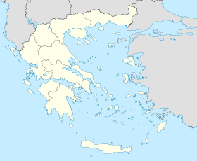
Andritsaina
Contenu soumis à la licence CC-BY-SA. Source : Article Andritsaina de Wikipédia en français (auteurs)
Regardez d'autres dictionnaires:
Andritsaina — Infobox Greek Dimos name = Andritsaina name local = Ανδρίτσαινα periph = West Greece prefec = Elis province = population = 2152 population as of = 2001 population ref = [http://web.archive.org/web/20060413201756/http://www.statistics.gr/gr… … Wikipedia
Andritsaina — Gemeinde Andritsena Δήμος Ανδριτσαίνης (Ανδρίτσαινα) DEC … Deutsch Wikipedia
Andritsena — Andritsaina 37°38′49″N 21°54′14″E / 37.64694, 21.90389 Andritsaina, ou aussi Andritsena (Ανδρίτσαινα), est une commune de la Préfecture d … Wikipédia en Français
Daphnoula — Dafnoula Δαφνούλα Location … Wikipedia
Matesi — Μάτεσι Location … Wikipedia
Ilia Prefecture — Infobox Pref GR name = Elis name local = Νομός Ηλείας periph = West Greece capital = Pyrgos population = 198,763 population as of = 2005 pop rank = 13th pop dens = 75.9 popdens rank = 13th area = 2,618 area rank = 22nd postal code = 27x xx area… … Wikipedia
Greek National Road 76 — (Pyrgos Andritsaina Megalopoli) is a west to east highway linking 2 km W of Krestena with GR 9/E55, Andritsaina and SE of Megalopoli (until 2003, in Megalopoli). The highway west to Andritsaina is unofficially designated as GR 76 The west to … Wikipedia
Karmio — Karmi or Karmio (Greek, Modern: Κάρμιο, Katharevousa: ον), older form: o and on is a little village located 7 km northeast ofAndritsaina and is also in that municipal district and the municipality, its 2001 population was 23 for the village and… … Wikipedia
Rovia — (Greek: Ρόβια) is a little village near Andritsaina, its 2001 population was 44 for the village and is ranked 6th in the municipality. Rovia is connected with the GR 76 (Megalopoli Andritsaina Krestena Pyrgos) along with several other roads.… … Wikipedia
Kato Samiko — Κάτω Σαμικό Location … Wikipedia
 Grèce
Grèce
