Lightning Ridge
Contenu soumis à la licence CC-BY-SA. Source : Article Lightning Ridge de Wikipédia en français (auteurs)
Regardez d'autres dictionnaires:
Lightning Ridge — Staat: Australien Bundesstaat … Deutsch Wikipedia
Lightning Ridge — Original name in latin Lightning Ridge Name in other language LHG, Lajtning Ridzh, Lightning Ridge, Лайтнинг Ридж State code AU Continent/City Australia/Sydney longitude 29.42743 latitude 147.97865 altitude 149 Population 2685 Date 2012 02 28 … Cities with a population over 1000 database
Lightning Ridge — /ˌlaɪtnɪŋ ˈrɪdʒ/ (say .luytning rij) noun an opal mining settlement in north western NSW; popular tourist area. Lightning Ridge lies in territory traditionally inhabited by the Kamilaroi people. Surface opal was discovered here in 1902, the field …
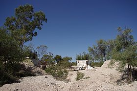
Lightning Ridge, New South Wales — Infobox Australian Place | type = town name = Lightning Ridge state = New South Wales caption = Fossicking field in Lightning Ridge lga = Walgett Shire county = Finch postcode = 2834 est = pop = 1,826 elevation= 170 maxtemp = mintemp = rainfall … Wikipedia
Lightning Ridge Airport — Infobox Airport name = Lightning Ridge Airport nativename = nativename a = nativename r = image width = caption = IATA = LHG ICAO = YLRD type = Public owner = operator = city served = location = Lightning Ridge, New South Wales elevation f =… … Wikipedia
Lightning — Cette page d’homonymie répertorie les différents sujets et articles partageant un même nom. Sur les autres projets Wikimedia : « Lightning », sur le Wiktionnaire (dictionnaire universel) Lightning signifie « éclair » en… … Wikipédia en Français
Ridge — /rɪdʒ/ (say rij) noun Colloquial the, Lightning Ridge, NSW …
Ridge Farm Studio — was one of the very first residential recording studios in the United Kingdom. The studio operated for over twenty five years as a world class residential recording studio. Ridge Farm Studio had many prominent artists, musicians and producers… … Wikipedia
Battle of Edson's Ridge — Infobox Military Conflict conflict=Battle of Edson s Ridge partof=the Pacific Theatre of World War II caption=A United States Marine stands near some of the fighting positions on Hill 123 on Edson s Ridge after the battle. Edson s command post… … Wikipedia
Oak Ridge Symphony Orchestra — The Oak Ridge Symphony Orchestra is a community based orchestra in Oak Ridge, Tennessee. The founder and first conductor was Waldo Cohn, a Manhattan Project biochemist and an accomplished cellist who started hosting chamber music sessions in his… … Wikipedia
 Les mines de Lightning Ridge
 Australie

