Laajalahti

Laajalahti
Laajalahti
Géographie humaine
Pays côtier(s) Drapeau de Finlande Finlande
Géographie physique
Type Baie
Localisation Golfe de Finlande
Coordonnées 60° 11′ 46″ N 24° 50′ 24″ E / 60.196, 24.8460° 11′ 46″ Nord
       24° 50′ 24″ Est
/ 60.196, 24.84
  

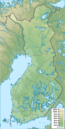
Géolocalisation sur la carte : Finlande

(Voir situation sur carte : Finlande)
Laajalahti

Laajalahti est une baie du golfe de Finlande parcourue par la frontière maritime qui sépare les deux villes finlandaises les plus peuplées, c'est-à-dire la capitale Helsinki et sa voisine occidentale, Espoo.

Géographie

Laajalahti est située dans la région d'Uusimaa et donc dans la province de Finlande méridionale. Elle est bordée à l'ouest par Espoo, plus précisément le super-district de Suur-Tapiola et les quartiers d'Otaniemi et Laajalahti. Au sud-est on trouve deux îles appartenant à la municipalité d'Helsinki: Lehtisaari et Kuusisaari. Enfin, la côte nord-est correspond à la partie centrale du district de Munkkiniemi, toujours à Helsinki.


Wikimedia Foundation. 2010.

Contenu soumis à la licence CC-BY-SA. Source : Article Laajalahti de Wikipédia en français (auteurs)

Игры ⚽ Поможем решить контрольную работу

Regardez d'autres dictionnaires:

  • Laajalahti — Infobox Espoo Name = Laajalahti Caption = Main district = Suur Tapiola Inner district = Ruukinranta, Pohjois Laajalahti Population = 3,512 (2006) Language = Finnish = 90.2 Swedish = 6.0 Other = 3.8 Jobs = 1,865Laajalahti ( sv. Bredvik) is a… …   Wikipedia

  • Munkkiniemi — Munksnäs Subdivisio …   Wikipedia

  • Districts of Espoo — This is an alphabetical list of the fifty districts of Espoo. Swedish names are given in parentheses. Bodom ¹ Espoon keskus (Esbo centrum) Espoonkartano (Esbogård) Espoonlahti (Esboviken) Gumböle ¹ Haukilahti (Gäddvik) Henttaa (Hemtans) Högnäs ¹… …   Wikipedia

  • Rantaraitti — The rantaraitti is an urban hiking route along the coastline of Espoo, Finland, bordering the Gulf of Finland. The approximate total length of the route is 27 km.Most of the route goes very near the coastline. At some places, it has to divert… …   Wikipedia

  • Drumsösundet — Lauttasaarensalmi Lauttasaarensalmi Superficie env. 1 km2 Profondeur < 12 m (max) Type Détroit Localisation Golfe de Finlande (océan Atlantique) Pays côtier(s) …   Wikipédia en Français

  • Détroit de Lauttasaari — Lauttasaarensalmi Lauttasaarensalmi Superficie env. 1 km2 Profondeur < 12 m (max) Type Détroit Localisation Golfe de Finlande (océan Atlantique) Pays côtier(s) …   Wikipédia en Français

  • Lauttasaarensalmi — Géographie humaine Pays côtier(s)  Finlande Pont(s) Pont de Lauttasaari, pont de Lapinlahti …   Wikipédia en Français

  • Vanhankaupunginlahti — La bahía de Vanhankaupunginlahti (en finés: bahía de la ciudad vieja) y la zona de marismas adyacente a Viikki, con unas 316 hectáreas de extensión, se encuentra situada en el centro geográfico de Helsinki, lo que confiere a esta área de un… …   Wikipedia Español

  • Otaniemi — Otnäs   District of Espoo   Location of Otaniemi withi …   Wikipedia

  • Matinkylä — Mattby   District of Espoo   Location of Matinkylä …   Wikipedia

Share the article and excerpts

Direct link
Do a right-click on the link above
and select “Copy Link”