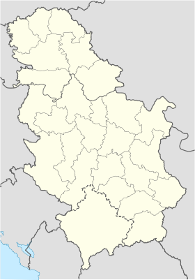
Komarani
- Komarani
-
Komarani (en serbe cyrillique : Комарани) est un village de Serbie situé dans la municipalité de Nova Varoš, district de Zlatibor. En 2002, il comptait 346 habitants[1], dont 345 Serbes (99,71 %)[2].
Démographie
Évolution démographique
| 1948 |
1953 |
1961 |
1971 |
1981 |
1991 |
2002 |
| 637 |
686 |
703 |
595 |
460 |
396 |
346[1] |
Notes et références
- ↑ a et b (sr) Livre 9, Population, analyse comparative de la population en 1948, 1953, 1961, 1971, 1981, 1991 et 2002, données par localités, Institut de statistique de la République de Serbie, Belgrade, mai 2004 (ISBN 86-84433-14-9)
- ↑ (sr) Livre 1, Population, origine nationale ou ethnique, données par localités, Institut de statistique de la République de Serbie, Belgrade, février 2003 (ISBN 86-84433-00-9)
Voir aussi
Articles connexes
Liens externes
Wikimedia Foundation.
2010.
Contenu soumis à la licence CC-BY-SA. Source : Article Komarani de Wikipédia en français (auteurs)
Regardez d'autres dictionnaires:
Nova Varos — Nova Varoš Pour les articles homonymes, voir Nova et Varoš. Nova Varoš Нова Варош [[Image:|100px|center|Blason]] [[Image:|100px|center|Drapaeau]] … Wikipédia en Français
Nova Varoš — Pour les articles homonymes, voir Nova Varoš (Banja Luka), Nova et Varoš. Nova Varoš Нова Варош … Wikipédia en Français
Syrmia — Srem redirects here. For other meanings of Srem and Srem , see Srem (disambiguation). Map of the Syrmia region … Wikipedia
Mačva — Macso redirects here. For the Romanian village of Măceu, called Mácsó in Hungarian, see Bretea Română. Map of the Mačva region Mačva (Serbian Cyrillic: Мачва, pronounced [mâːt͡ʃv̞a]) is a geographical region in Serbia, mostly situated in the … Wikipedia
Zlatibor — For other meanings see: Zlatibor (disambiguation). Zlatibor landscape Zlatibor (Serbian Cyrillic: Златибoр, pronounced [zlǎtibɔ̝r]) is a mountain region situated in the western part of Serbia, a part of the Dinaric Alps. The mountain range… … Wikipedia
Podrinje — For the village in Croatia, see Podrinje, Croatia. The Drina valley looking towards Bajina Bašta Podrinje (Cyrillic: Подриње) is the Slavic name of the Drina river basin, known in English as the Drina Valley, located in Serbia (Central Serbia)… … Wikipedia
Nova Varoš — Нова Варош Municipality and Town Nova Varoš … Wikipedia
Lim River — Infobox River | river name = Lim image size = 180px caption = Drainage basin of Drina in Serbia origin = Kuči region, northeast Montenegro mouth = Drina, near Brodar, Bosnia and Herzegovina basin countries = Montenegro, Albania, Serbia and Bosnia … Wikipedia
Stari Vlah — (Serbian: Стари Влах, pronounced [stâːriː vlâx], meaning Old Vlach) is a historic and geographical region in Southwestern Serbia. Geography Stari Vlah contains 7 municipalities of Serbia: Priboj, Nova Varoš, Prijepolje, Užice, Ivanjica,… … Wikipedia
Gornji Breg (region) — Gornji Breg (Горњи Брег) is a small geographical region in Serbia. It is located in north eastern Bačka, in the Vojvodina province. There is also a village named Gornji Breg, which is situated in this region. See also Bačka Vojvodina … Wikipedia
 Serbie
