Kolhorn
- Kolhorn
-
Wikimedia Foundation.
2010.
Contenu soumis à la licence CC-BY-SA. Source : Article Kolhorn de Wikipédia en français (auteurs)
Regardez d'autres dictionnaires:
Kolhorn — Dutch town locator maps mun town caption = The town centre (dark green) and the statistical district (light green) of Kolhorn in the municipality of Niedorp.Kolhorn (coord|52|48|N|4|53|E|type:city(645)) (West Frisian: Koldhorn ) is a town in the… … Wikipedia
Bahnstrecke Nieuwediep–Amsterdam — Den Helder–Amsterdam Streckenlänge: 81 km Spurweite: 1435 mm (Normalspur) Stromsystem: 1,5 kV = Höchstgeschwindigkeit … Deutsch Wikipedia
Canal De Stolpen À Schagen — Kanaal Stolpen Schagen Caractéristiques Histoire Année début travaux années 1930 Géographie Début Canal de la Mer du Nord à De Stolpen Fin Canal de Schagen à Kolhorn à … Wikipédia en Français
Canal de Stolpen a Schagen — Canal de Stolpen à Schagen Canal de Stolpen à Schagen Kanaal Stolpen Schagen Caractéristiques Histoire Année début travaux années 1930 Géographie Début Canal de la Mer du Nord à De Stolpen Fin Canal de Schagen à Kolhorn à … Wikipédia en Français
Canal de Stolpen à Schagen — Kanaal Stolpen Schagen Caractéristiques Histoire Année début travaux années 1930 Géographie Début Canal de la Mer du Nord à De Stolpen Fin … Wikipédia en Français
Canal de stolpen à schagen — Kanaal Stolpen Schagen Caractéristiques Histoire Année début travaux années 1930 Géographie Début Canal de la Mer du Nord à De Stolpen Fin Canal de Schagen à Kolhorn à … Wikipédia en Français
Liste aller niederländischen Gemeinden A–L — In diese Liste werden alle Gemeinden, die auf dem Gebiet der jetzigen Niederlande bestehen oder bestanden haben, aufgenommen. Die Liste beginnt im Jahr 1805/10. Vor 1830 können die Angaben unvollständig sein. Kleinere Grenzkorrekturen oder… … Deutsch Wikipedia
Niedorp — Gemeinde Niedorp Flagge Wappen Provinz Nordholland Bürgermeister … Deutsch Wikipedia
Barsingerhorn — 52°47′7″N 4°50′30″E / 52.78528, 4.84167 … Wikipédia en Français
Liste Des Canaux Des Pays-Bas — Cet article liste les canaux des Pays Bas. Canal de l Aar (Aarkanaal) Aduarderdiep Canal de l Amstel au Drecht (Amstel Drechtkanaal) Canal d Amsterdam au Rhin (Amsterdam Rijnkanaal) Canal d Almelo à De Haandrik (Kanaal Almelo De Haandrik) Canal d … Wikipédia en Français
 Pays-Bas
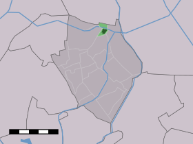

 Vue sur Kolhorn
 Catégories :
