Kitumbeine
- Kitumbeine
-
Mont Kitumbeine
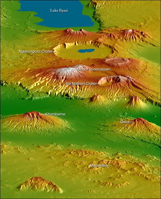
Le mont Kitumbeine est un volcan éteint du nord de la Tanzanie, situé au nord-est du massif du Ngorongoro. À l'instar de son voisin le mont Gelai situé à 34 kilomètres au nord-nord-ouest, il domine l'est de la vallée du grand rift, culminant à une altitude de 2 865 mètres et surplombant la vallée de 1 770 mètres[1]. Il est également situé à 36 kilomètres au sud-est du volcan actif Ol Doinyo Lengaï.
Référence

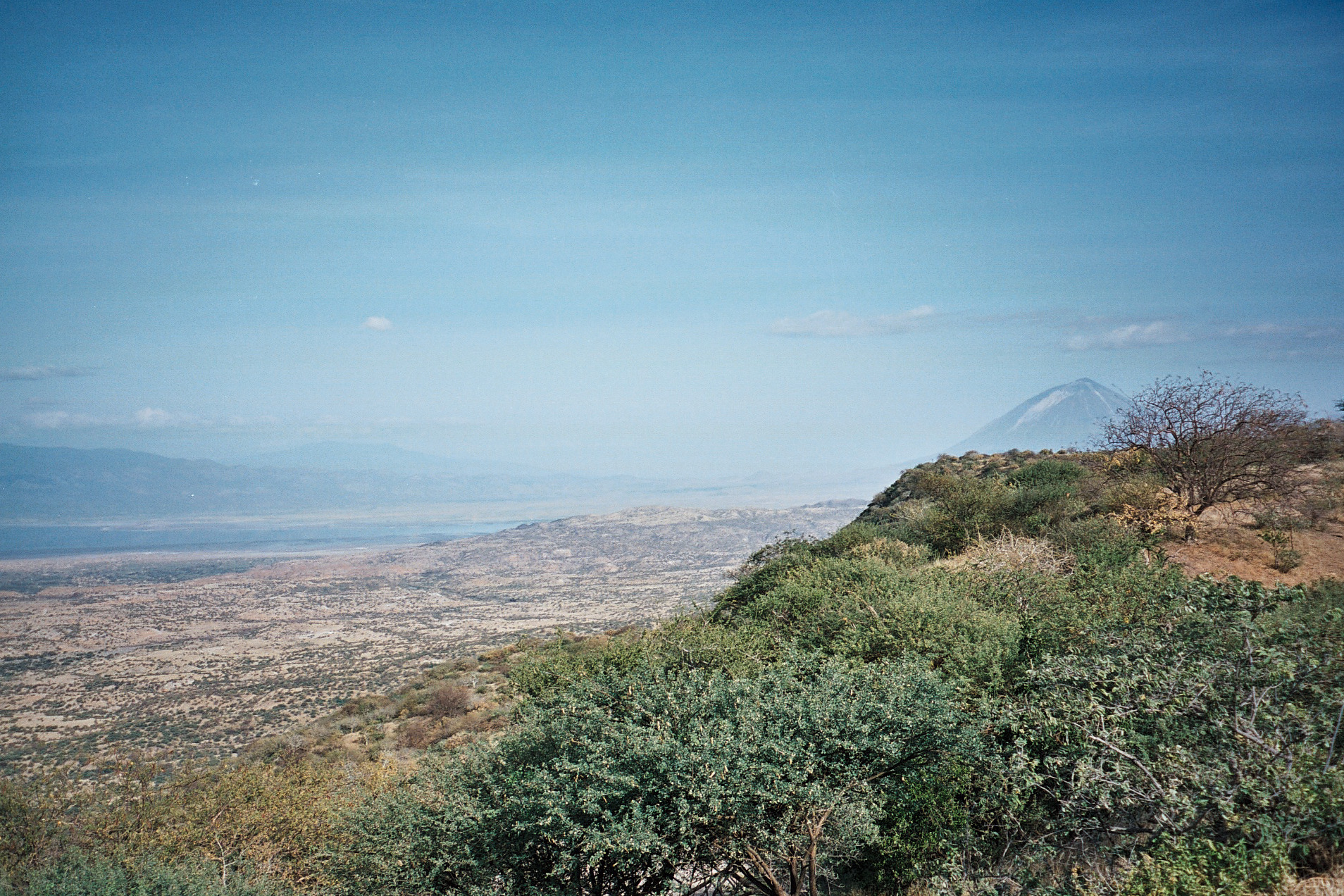
Vue de la
vallée du grand rift à l'extrême-nord de la Tanzanie. Plusieurs escarpements sont visibles en premier plan. Le volcan actif
Ol Doinyo Lengaï, distant de 45 km par rapport au point de vue, domine l'image à droite. Le
lac Natron occupe le fond de la vallée sur la gauche de l'image où le flanc méridional du
mont Gelai est également visible. Enfin, le Kitumbeine est visible en arrière plan, au centre gauche de l'image, à environ 75 km de distance
 Portail de la Tanzanie
 Portail de la montagne
 Portail de la volcanologie
Catégories : Volcan éteint | Volcan rouge | Montagne de Tanzanie | Volcan de Tanzanie
Wikimedia Foundation.
2010.
Contenu soumis à la licence CC-BY-SA. Source : Article Kitumbeine de Wikipédia en français (auteurs)
Regardez d'autres dictionnaires:
Kitumbeine — BASEPAGENAME is an administrative ward in the Monduli district of the Arusha Region of Tanzania. According to the 2002 census, the ward has a total population of 13,629. [cite web|url=http://www.tanzania.go.tz/census/census/districts/monduli.htm|t… … Wikipedia
Strongylopus kitumbeine — Strongylopus kitumbeine … Wikipédia en Français
Strongylopus kitumbeine — Strongylopus kitumbeine … Wikipédia en Français
Mont Kitumbeine — Carte topographique du massif du Ngorongoro montrant le mont Kitumbeine au second plan à gauche Géographie Altitude 2 … Wikipédia en Français
Strongylopus kitumbeine — Taxobox name = Strongylopus kitumbeine status = VU | status system = IUCN3.1 regnum = Animalia phylum = Chordata classis = Amphibia ordo = Anura familia = Ranidae genus = Strongylopus species = S. kitumbeine binomial = Strongylopus kitumbeine… … Wikipedia
Strongylopus kitumbeine — Strongylopus kitumbeine Estado de conservación … Wikipedia Español
Liste des sommets ultra-proéminents d'Afrique — Cet article recense les sommets ultra proéminents d Afrique, c est à dire les sommets dont la proéminence topographique (ou hauteur de culminance) dépasse 1 500 m. Sommaire 1 Dénombrement 2 Liste 2.1 Afrique de l Ouest … Wikipédia en Français
Monduli — District Map of Arusha Region s Districts with Monduli highlighted. Country Tanzania … Wikipedia
Strongylopus — Taxobox name = Strongylopus regnum = Animalia phylum = Chordata subphylum = Vertebrata classis = Amphibia ordo = Anura familia = Ranidae genus = Strongylopus genus authority = Tschudi, 1838 Strongylopus is a genus of true frogs.pecies*… … Wikipedia
Crater Highlands — Topographical map of the Crater Highlands, looking from the north to the southwest. The Crater Highlands are a region along the East African Rift in Tanzania, located in a spreading zone at the intersection of branches of the African and Somali… … Wikipedia

 Tanzanie