Keene (New Hampshire)

Keene (New Hampshire)

42° 56′ 01″ N 72° 16′ 41″ W / 42.933611, -72.278056

Keene
Surnom : « Elm City » (« Ville des Ormes »)
Administration
Pays Drapeau des États-Unis États-Unis
État New Hampshire New Hampshire
Comté Cheshire
Maire Dale Pregent
Site web Consulter
Historique
Fondation 1736
Municipalité depuis 1753 (town) 1874 (city)
Démographie
Population (2000) 22 893 hab.
Densité 235 hab./km²
Géographie
Coordonnées 42° 56′ 01″ Nord
       72° 16′ 41″ Ouest
/ 42.933611, -72.278056
Superficie totale 97,3 km2
· dont terre 96,6 km2 (99,28 %)
· dont eau 0,7 km2 (0,72 %)
Fuseau horaire EST (UTC-5)
Voir la carte administrative
City locator 14.svg
Voir la carte topographique
City locator 14.svg

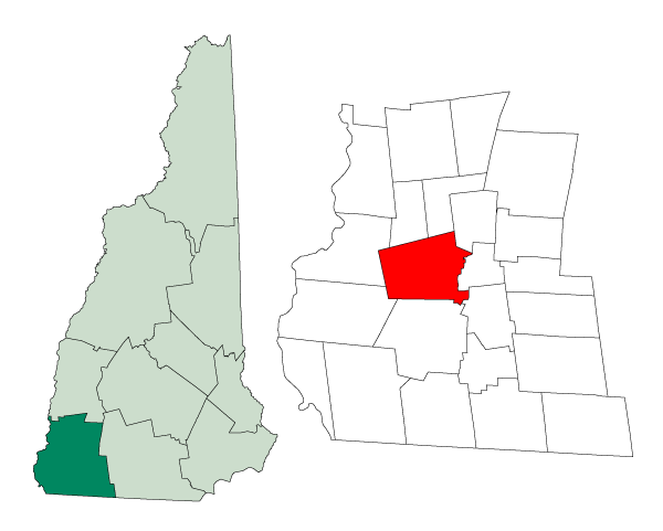
La ville de Keene est le siège du comté de Cheshire, dans l’État du New Hampshire, aux États-Unis. Lors du recensement de 2000, elle comptait 22 893 habitants.

Elle est bien connue pour le « Pumpkin Festival » (le festival de citrouilles), un festival annuel qui prend lieu à la rue Main. Chaque année, le festival attire à peu près 70 000 personnes. Elle l'est également pour avoir accueilli les scènes du film Jumanji de Joe Johnston.

Jumelage

L'école Keene High School ainsi que sa voisine à Swanzey, Monadnock Regional High School, participent à un échange culturel avec le lycée Lumière de Luxeuil-les-Bains, depuis 1991.

Source

Sur les autres projets Wikimedia :


Wikimedia Foundation. 2010.

Contenu soumis à la licence CC-BY-SA. Source : Article Keene (New Hampshire) de Wikipédia en français (auteurs)

Игры ⚽ Поможем сделать НИР

Regardez d'autres dictionnaires:

  • Keene (New Hampshire) — Keene Spitzname: Elm City …   Deutsch Wikipedia

  • Keene, New Hampshire — Infobox Settlement official name = City of Keene settlement type = City nickname = Elm City motto = imagesize = image caption = image mapsize = 250px map caption = Location in Cheshire County, New Hampshire mapsize1 = map caption1 = subdivision… …   Wikipedia

  • Beaver Mills (Keene, New Hampshire) — Infobox nrhp name = Beaver Mills nrhp type = hd locmapin = USA mapwidth = 250 caption = locator x = locator y = location = 93 115 Railroad Street Keene, New Hampshire nearest city = lat degrees = 42 lat minutes = 55 lat seconds = 55 lat direction …   Wikipedia

  • Keene (Nuevo Hampshire) — Keene Ciudad de los Estados Unidos Keene en 1912 …   Wikipedia Español

  • New Hampshire Route 12 — Route information Maintained by NHDOT Length: 62.64 mi …   Wikipedia

  • New Hampshire Phantoms — Full name New Hampshire Phantoms Football Club Nickname(s) The Phantoms Founded 1996 …   Wikipedia

  • New Hampshire locations by per capita income — New Hampshire is the seventh richest state in the United States of America, with a per capita income of $23,844 (2000) and a personal per capita income of $34,702 (2003). New Hampshire counties ranked by per capita income There are ten counties… …   Wikipedia

  • New Hampshire communities by population — The 234 incorporated cities and towns in the New Hampshire ranked by population, from the 2010 United States Census. Location of New Hampshire in the United States …   Wikipedia

  • Keene, New York — Infobox Settlement official name = Keene, New York settlement type = Town nickname = motto = imagesize = image caption = Mount Marcy from Mount Haystack image |pushpin pushpin label position = pushpin map caption =Location within the state of New …   Wikipedia

  • New Hampshire communities by household income — The 234 incorporated cities and towns in the New Hampshire ranked by household income, calculated in 2006, and published in 2007. Rank Community Median Household Income 1 Windham, New Hampshire $94,794 2 Hollis, New Hampshire $92,847 3 …   Wikipedia

Share the article and excerpts

Direct link
Do a right-click on the link above
and select “Copy Link”