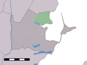
Katwoude
Contenu soumis à la licence CC-BY-SA. Source : Article Katwoude de Wikipédia en français (auteurs)
Regardez d'autres dictionnaires:
Katwoude — Dutch town locator maps mun town caption = The statistical district of Katwoude in the municipality of Waterland.Katwoude (coord|52|28|N|5|3|E|type:city(230)) is a village in the Dutch province of North Holland. It is a part of the municipality… … Wikipedia
Waterland — Gemeinde Waterland Flagge Wappen Provinz … Deutsch Wikipedia
Wetterland — Gemeinde Waterland Flagge Wappen Provinz Nordholland … Deutsch Wikipedia
Anciennes communes de la Hollande-Septentrionale — En 1812, la province néerlandaise de la Hollande Septentrionale comptait 111 communes. En 2011, il n y en avait plus que 60. Sommaire 1 Étapes principales des fusions 2 Liste des fusions des communes de la Hollande Septentrionale 2 … Wikipédia en Français
Waterland (commune) — Pour les articles homonymes, voir Waterland. Waterland … Wikipédia en Français
Broek in Waterland — 52°26′10″N 4°59′39″E / 52.43611, 4.99417 … Wikipédia en Français
Waterland — Infobox Settlement official name = Waterland imagesize = 250px image caption = The village Marken flag size = 150x75px image shield = Waterlandwapen.jpg shield size = 150x75px mapsize = 250px map caption = Location of Waterland subdivision type … Wikipedia
Kinderdijk — Coordinates: 51°53′N 4°38′E / 51.883°N 4.633°E / 51.883; 4.633 … Wikipedia
List of places in the Netherlands — This is an alphabetical list of places (cities, towns, villages) in the Netherlands. Lists per province can be found at:* List of towns in Groningen * List of towns in Friesland * List of towns in Drente * List of towns in Overijssel * List of… … Wikipedia
De Adriaan, Haarlem — Windmill De Adriaan De Adriaan is a windmill in the Netherlands that burnt down in 1932 and was rebuilt in 2002. The original windmill dates from 1779 and the mill has been a distinctive part of the skyline of Haarlem for centuries. Contents … Wikipedia


