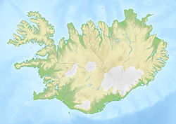
Hrauney
Contenu soumis à la licence CC-BY-SA. Source : Article Hrauney de Wikipédia en français (auteurs)
Regardez d'autres dictionnaires:
Smaeyjar — Smáeyjar Smáeyjar Carte des îles Vestmann avec les Smáeyjar à l ouest de Heimaey. Géographie Pays … Wikipédia en Français
Smáeyjar — Carte des îles Vestmann avec les Smáeyjar à l ouest de Heimaey. Géographie Pays … Wikipédia en Français
Vestmannaeyjar — Vestmannaeyjar, IcelandCliffs of Heimaey Location of Vestmannaeyjar in Iceland (lower left)CountyVestmannaeyjarConstituencySouthArea 16.3 km² (6.3 sq mi) Population Total (2008) Density 4038 … Wikipedia
South Rona — Infobox Scottish island | GridReference=NG619563 celtic name= Rònaigh norse name= Hrauney meaning of name= Norse rough island area=930 ha area rank=51 highest elevation=125 m Population=2 population rank= 88= main settlement=Acarsaid Mhòr island… … Wikipedia
Ronay — Infobox Scottish island | GridReference=NF895555 latitude=57.48 longitude= 7.18 celtic name=Rònaigh norse name=Hrauney meaning of name= Rough island from Norse area= 563 ha area rank= 69 highest elevation= 115 m Population=uninhabited since 1920… … Wikipedia
Rona (Schottland) — Rona Gneisformation auf Rona Gewässer Atlantischer Ozean Inselgruppe … Deutsch Wikipedia
Ronaigh — Geografische Lage von Rona an der Nordwestküste Schottlands Gneis Formation auf Rona Rona (schot … Deutsch Wikipedia
Rònaigh — Geografische Lage von Rona an der Nordwestküste Schottlands Gneis Formation auf Rona Rona (schot … Deutsch Wikipedia
South Rona — Geografische Lage von Rona an der Nordwestküste Schottlands Gneis Formation auf Rona Rona (schot … Deutsch Wikipedia
Vestmannaeyjabær — Gemeinde Vestmannaeyjar (Vestmannaeyjabær) Basisdaten Staat: Island Region: Suðurland Einwohnerzahl: 4040 (1. Dezember 2007) Fläche: 17 km² … Deutsch Wikipedia
 Islande
 Islande
