Albergen
Contenu soumis à la licence CC-BY-SA. Source : Article Albergen de Wikipédia en français (auteurs)
Regardez d'autres dictionnaires:
Albergen — Albergen, s. Aprikosenbaum … Meyers Großes Konversations-Lexikon
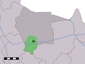
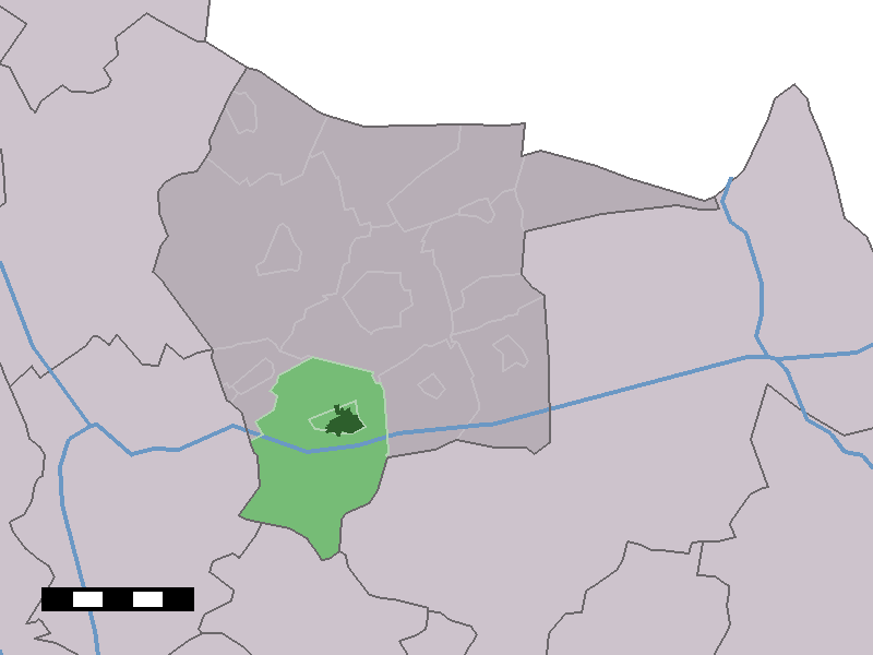
Albergen — Dutch town locator maps mun town caption = The town centre (dark green) and the statistical district (light green) of Albergen in the municipality of Tubbergen.Albergen (coord|52|22|N|6|46|E|type:city(1990)) is a town in the Dutch province of… … Wikipedia
Canal D'Almelo À Nordhorn — Kanaal Almelo Nordhorn Nordhorn Almelo Kanal Situation du canal sur une carte des Pays Bas Caractéristiques Statut actuel radié (réouverture en cours d étude) … Wikipédia en Français
Canal d'Almelo a Nordhorn — Canal d Almelo à Nordhorn Canal d Almelo à Nordhorn Kanaal Almelo Nordhorn Nordhorn Almelo Kanal Situation du canal sur une carte des Pays Bas Caractéristiques Statut actuel radié (réouverture en cours d étude) … Wikipédia en Français
Canal d'Almelo à Nordhorn — 52° 25′ 35″ N 7° 04′ 36″ E / 52.4264, 7.07667 … Wikipédia en Français
Canal d'almelo à nordhorn — Kanaal Almelo Nordhorn Nordhorn Almelo Kanal Situation du canal sur une carte des Pays Bas Caractéristiques Statut actuel radié (réouverture en cours d étude) … Wikipédia en Français
Tubbergen — Héraldique … Wikipédia en Français
Tubbergen — Infobox Settlement official name = Tubbergen mapsize = 280px subdivision type = Country subdivision name = Netherlands subdivision type1 = Province subdivision name1 = Overijssel area footnotes = (2006) area total km2 = 147.40 area land km2 = 146 … Wikipedia
List of places in the Netherlands — This is an alphabetical list of places (cities, towns, villages) in the Netherlands. Lists per province can be found at:* List of towns in Groningen * List of towns in Friesland * List of towns in Drente * List of towns in Overijssel * List of… … Wikipedia
Twente — (or Twenthe) is a non administrative region in the eastern Netherlands, probably named after the Tuihanti, a tribe that settled in that region in the beginning of our era.Twente contains the most urbanised and easterly part of the province of… … Wikipedia
 Pays-Bas