Reutum
- Reutum
-
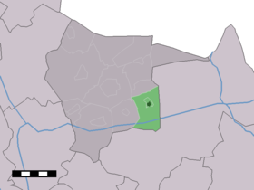
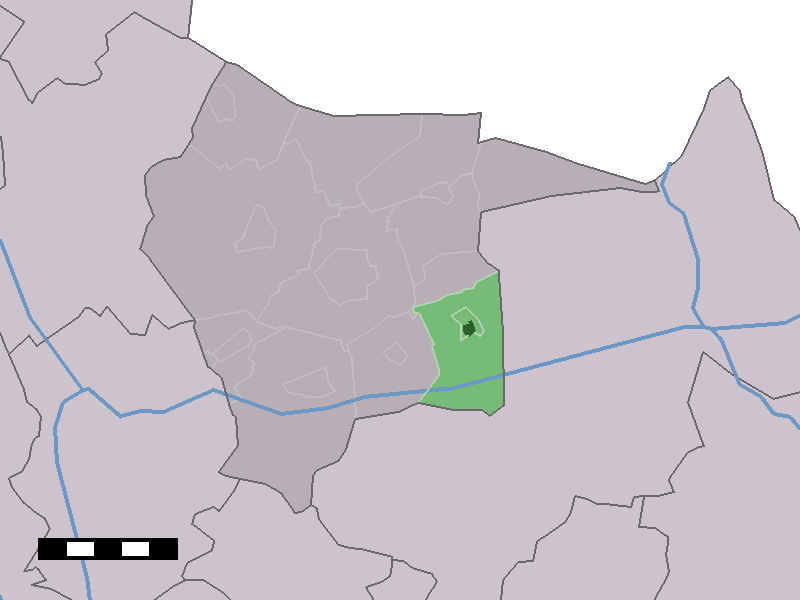
Reutum est un village néerlandais de la commune de Tubbergen, situé dans la province d'Overijssel.
Géographie
Reutum est situé dans le nord-est de la province d'Overijssel, sur la route d'Almelo à Ootmarsum, sur le Canal d'Almelo à Nordhorn.
Histoire
En 1840, Reutum comptait 114 maisons et 670 habitants, y compris les habitants de Haarle[1].
Référence
- ↑ Alphabetisch register van alle bewoonde oorden des Rijks, Departement van Oorlog, Éd. Erven Doorman, 's-Gravenhage, 1850
Wikimedia Foundation.
2010.
Contenu soumis à la licence CC-BY-SA. Source : Article Reutum de Wikipédia en français (auteurs)
Regardez d'autres dictionnaires:
Reutum — Dutch town locator maps mun town caption = The town centre (dark green) and the statistical district (light green) of Reutum in the municipality of Tubbergen.Reutum (coord|52|23|N|6|51|E|type:city(464)) is a town in the Dutch province of… … Wikipedia
Hoofdklasse (Fußball) — Die Hoofdklasse ist die zweithöchste Spielklasse im niederländischen Frauenfußball. Sie wurde im Sommer 2007 von der Eredivisie als höchste Spielklasse abgelöst. Es gibt im niederländischen Männerfußball ebenfalls eine Hoofdklasse. Allerdings… … Deutsch Wikipedia
Tubbergen — Héraldique … Wikipédia en Français
Tubbergen — Infobox Settlement official name = Tubbergen mapsize = 280px subdivision type = Country subdivision name = Netherlands subdivision type1 = Province subdivision name1 = Overijssel area footnotes = (2006) area total km2 = 147.40 area land km2 = 146 … Wikipedia
Kinderdijk — Coordinates: 51°53′N 4°38′E / 51.883°N 4.633°E / 51.883; 4.633 … Wikipedia
List of places in the Netherlands — This is an alphabetical list of places (cities, towns, villages) in the Netherlands. Lists per province can be found at:* List of towns in Groningen * List of towns in Friesland * List of towns in Drente * List of towns in Overijssel * List of… … Wikipedia
De Adriaan, Haarlem — Windmill De Adriaan De Adriaan is a windmill in the Netherlands that burnt down in 1932 and was rebuilt in 2002. The original windmill dates from 1779 and the mill has been a distinctive part of the skyline of Haarlem for centuries. Contents … Wikipedia
Nordhorn-Almelo-Kanal — Lage des Kanals Der Nordhorn Almelo Kanal (Abkürzung: NAK) ist eine Teilstrecke des Linksemsischen Kanalnetzes. Inhaltsverzeichnis 1 Lage … Deutsch Wikipedia
Tubbergen — Gemeinde Tubbergen Flagge Wappen Provinz Overijssel Bürgermeister … Deutsch Wikipedia
Albergen — 52° 22′ 18″ N 6° 45′ 43″ E / 52.3717, 6.76194 … Wikipédia en Français
 Pays-Bas