Gosseldange
Contenu soumis à la licence CC-BY-SA. Source : Article Gosseldange de Wikipédia en français (auteurs)
Regardez d'autres dictionnaires:
Gosseldange — ( lb. Gousseldeng, de. Gosseldingen) is a small town in the commune of Lintgen, in central Luxembourg. As of 2001, the town has a population of 442.Near to the town of Gosseldange is the Gousselerbierg, under which passes the Gousselerbierg… … Wikipedia
Gosseldange — (luxemburgisch: Gousseldeng) ist eine kleine Ortschaft, die der Gemeinde Lintgen zugehört und im Kanton Mersch in Luxemburg liegt. Im Jahre 2001 hatte es 442 Einwohner. Die Autobahn 7 verläuft westlich, 400 Meter entfernt. Durch Gosseldange… … Deutsch Wikipedia
Lintgen — Infobox Luxembourg commune name = Lintgen luxname = Lëntgen arms = Coat of arms lintgen luxbrg.png LAU2 = 12007 canton = Mersch district = LuxembourgLintgen ( lb. Lëntgen) is a commune and small town in central Luxembourg, in the canton of Mersch … Wikipedia
Gousselerbierg Tunnel — The Gousselerbierg Tunnel is a pair of a parallel road tunnels in the canton of Mersch, in central Luxembourg. The tunnels are named for the hill through which they pass, near the town of Gosseldange, in the commune of Lintgen. At 2,695 metres (8 … Wikipedia
Lintgen — Wappen Karte Basisdaten Distrikt: Luxemburg … Deutsch Wikipedia
Liste deutscher Bezeichnungen luxemburgischer Orte — In dieser Liste werden die deutschen und französischen Bezeichnungen luxemburgischer Orte einander gegenüber gestellt. Die französischen Namen sind die offiziellen . Alle Namen existieren auch in Luxemburgisch, werden aber hier nicht angegeben.… … Deutsch Wikipedia
Lëntgen — Wappen Karte Basisdaten Distrikt: Lu … Deutsch Wikipedia
Lintgen — 49°43′N 6°08′E / 49.717, 6.133 Lintgen … Wikipédia en Français
Liste des localités du Grand-Duché de Luxembourg — Liste des localités luxembourgeoises par ordre alphabétique avec indication du nom luxembourgeois et des communes Sommaire : Haut A B C D E F G H I J K L M N O P Q R S T U V W X Y Z … Wikipédia en Français
Liste des localités du Grand-Duché du Luxembourg — Liste des localités du grand duché de Luxembourg Liste des localités luxembourgeoises par ordre alphabétique avec indication du nom luxembourgeois et des communes Sommaire : Haut A B C D E F G H I J K L M N O P Q R S T U V W X Y Z … Wikipédia en Français
 Gosseldange
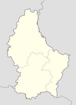

 Luxembourg