Gooloogong
Contenu soumis à la licence CC-BY-SA. Source : Article Gooloogong de Wikipédia en français (auteurs)
Regardez d'autres dictionnaires:
Gooloogong, New South Wales — Infobox Australian Place | type = town name = Gooloogong state = nsw caption = Hotel lga = Cowra Shire, Forbes Shire postcode = 2805 est = pop = 852 pop footnotes = elevation= 305 maxtemp = mintemp = rainfall = stategov = Burrinjuck, Dubbo fedgov … Wikipedia
Royce Simmons — Infobox rugby league biography playername = Royce Simmons fullname = Royce Simmons caption = Australian national rugby league player dateofbirth = birth date and age|1960|02|05|df=yes placeofbirth = Gooloogong, New South Wales countryofbirth =… … Wikipedia
Gooloogongia — Taxobox name = Gooloogongia fossil range = Late Devonian image width = 260px image caption = Life restoration of Gooloogongia loomesi regnum = Animalia phylum = Chordata subphylum = Vertebrata infraphylum = Gnathostomata classis = Osteichthyes… … Wikipedia
Contenu:Australie — Projet:Australie/Liste des articles Liste mise à jour régulièrement par MyBot (d · c · b) à partir des articles liés au bandeau {{Portail Australie}} Modifications récentes des articles ayant le bandeau de ce portail… … Wikipédia en Français
Forbes County — Map of all coordinates from Google Map of all coordinates from Bing Export all coordinates as KML … Wikipedia
Belubula River — Der Carcoar Staudamm am Belubula RiverVorlage:Infobox Fluss/KARTE fehlt Daten … Deutsch Wikipedia
Lachlan River — Infobox River river name = Lachlan River caption = The Lachlan River at Cowra origin = east of Gunning mouth = confluence with the Murrumbidgee River near Oxley basin countries = Australia length = 1450 km (901 mi) elevation = discharge =… … Wikipedia
Division of Hume — Hume Australian House of Representatives Division Division of Hume (green) within New South Wales Created: 1901 MP … Wikipedia
Snowball marches — Between October 1915 and February 1916, nine marches were held starting from various points in the state; the most notable was the first march from Gilgandra, known as the Cooee march. There was also a similar march in south eastern Queensland.… … Wikipedia
Cowra Shire Council — Infobox Australian Place | type = lga name = Cowra Shire state = nsw caption = Location in NSW pop = 13,260Census 2001 AUS|id=LGA12350|name=Cowra (A) (Local Government Area)|accessdate=2007 06 30|quick=on] area = 2810 est = seat = Cowra (116… … Wikipedia
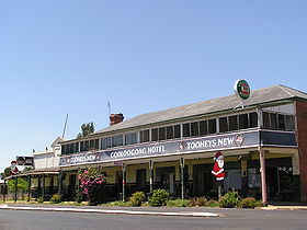 L'hôtel de Gooloogong
 Australie
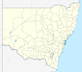
 Gooloogong


