Gmaps
- Gmaps
-
Carte généralisée
Une carte généralisée est un modèle topologique qui permet de représenter et de manipuler des objets subdivisés. Ce modèle a été défini à partir du modèle des cartes combinatoires afin de pouvoir représenter des objets avec ou sans bord, orientables ou non. Le principal avantage des cartes généralisées par rapport aux cartes combinatoires est le fait qu'elles sont homogènes en toute dimension. Cela simplifie les définitions et les algorithmes, ce qui fait que les cartes généralisées sont parfois utilisées même pour représenter des objets orientables sans bord.
Définition
La définition des cartes généralisées en dimension quelconque est donnée dans [1] et [2]:
Une carte généralisées de dimension n, (ou nG-carte) est un (n + 2)-uplet 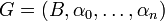 tel que~:
- B est un ensemble fini de brins ;
 sont des involutions sur B ;
 est une involution
  .
.
Une nG-carte représente un objet quasi-variété cellulaire orienté ou non, avec ou sans bord.
Voir aussi
Références
- ↑ Lienhardt P., Topological models for Boundary Representation : a comparison with n-dimensional generalized maps, Computer-Aided Design, Vol. 23, no.1, pp. 59-82 - 1991
- ↑ Lienhardt P., N-dimensional generalized combinatorial maps and cellular quasi-manifolds, International Journal on Computational Geometry and Applications, Vol. 4, n° 3, pp. 275-324 - 1994
 Portail des mathématiques
Catégories : Topologie algébrique | Théorie des graphes
Wikimedia Foundation.
2010.
Contenu soumis à la licence CC-BY-SA. Source : Article Gmaps de Wikipédia en français (auteurs)
Regardez d'autres dictionnaires:
Mobile GMaps — is a freeware (Creative Commons Attribution NonCommercial NoDerivs) that displays Google Maps and MSN Virtual Earth maps and satellite imagery on Java enabled mobile phones, PDAs or other devices. External links * [http://www.mgmaps.com Mobile… … Wikipedia
Structure Mapping Engine — In artificial intelligence and cognitive science, the structure mapping engine is an implementation in software of an algorithm for analogical matching based on the psychological theory of Dedre Gentner [1983] . The basis of Gentner s structure… … Wikipedia
SR-71 Blackbird — infobox Aircraft name = SR 71 Blackbird caption =An SR 71B Trainer over the Sierra Nevada Mountains of California in 1994. Note second cockpit is raised for the instructor. type = Strategic Reconnaissance manufacturer = Lockheed Skunk Works… … Wikipedia
Harrisburg, Illinois — For other uses, see Harrisburg (disambiguation). Harrisburg City City of Harrisburg … Wikipedia
Charnwood Forest — The summit of Beacon Hill … Wikipedia
Lockheed YF-12 — Infobox Aircraft name= YF 12 type= Interceptor manufacturer= Lockheed Corporation caption= YF 12A undergoing flight testing. designer= Clarence Kelly Johnson first flight= 7 August 1963 introduced= retired= status=Cancelled primary user= United… … Wikipedia
HMS Pandora (1779) — HMS Pandora was a 24 gun Porcupine class frigate of the Royal Navy, built by Adams and Barnard at Deptford, England and launched on 17 May 1779. She was deployed in North American waters during the American Revolutionary War but was put in… … Wikipedia
Upfield Rail Trail — NOTOC MelbourneBikePath DESCRIPTION= The Upfield Bike Path in Brunswick NAME= Upfield Rail Trail LENGTH= Approx 7 km DIFFICULTY= Easy HILLS= Flat HAZARDS= Numerous Road crossings. People exiting stations. Forklifts. WATER= PATH=Bitumen path BUS=… … Wikipedia
Oregon Coast Trail — The Oregon Coast Trail at Floras Lake, looking north to the BLM s New River Area of Critical Environmental Concern (ACEC) Length 425 mi (684 km) Location Pacific Ocean coast of Oregon, USA … Wikipedia
Capital City Trail — NOTOC MelbourneBikePath DESCRIPTION=Capital City Trail at Princes Park looking west NAME= Capital City Trail LENGTH=Approx 29 km DIFFICULTY=Easy HILLS= Minor hill at Rushall Station HAZARDS= WATER= Drinking fountains every 2km approx PATH= Shared … Wikipedia