Gelkenes
Contenu soumis à la licence CC-BY-SA. Source : Article Gelkenes de Wikipédia en français (auteurs)
Regardez d'autres dictionnaires:
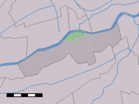
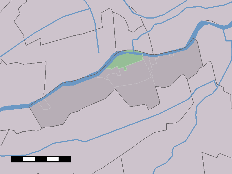
Gelkenes — Dutch town locator maps mun town caption = The village (dark green) and the statistical district (light green) of Gelkenes in the municipality of Liesveld.Gelkenes (coord|51|56|N|4|51|E|type:city(300)) is a town in the Dutch province of South… … Wikipedia
Schoonhoven — Infobox Settlement official name = Schoonhoven skylinesize = 280px flag size = 120x100px image shield = Schoonhoven wapen2.jpg shield size = 120x100px mapsize = 280px subdivision type = Country subdivision name = Netherlands subdivision type1 =… … Wikipedia
Liesveld — Infobox Settlement official name = Liesveld flag size = 120x100px image shield = Liesveld logo.png shield size = 120x100px mapsize = 280px subdivision type = Country subdivision name = Netherlands subdivision type1 = Province subdivision name1 =… … Wikipedia
Gorinchem railway station — Gorinchem Station statistics Coordinates … Wikipedia
Liesveld — Gemeinde Liesveld Flagge Wappen Provinz Südholland Bürgermeister … Deutsch Wikipedia
Graafland — 51°53′30″N 4°51′23″E / 51.89167, 4.85639 … Wikipédia en Français
Groot-Ammers — 51°55′25″N 4°49′14″E / 51.92361, 4.82056 … Wikipédia en Français
Langerak (Hollande-Méridionale) — Pour les articles homonymes, voir Langerak. 51°55′59″N 4°52′34″E / … Wikipédia en Français
Liesveld — Héraldique … Wikipédia en Français
Liesveld (hameau) — 51°55′56″N 4°49′57″E / 51.93222, 4.8325 … Wikipédia en Français
 Pays-Bas