Fort Pierre

Fort Pierre

44° 21′ 32″ N 100° 22′ 33″ W / 44.358889, -100.375833

Fort Pierre
Administration
Pays Drapeau des États-Unis États-Unis
État Dakota du Sud Dakota du Sud
Comté Stanley
Type de localité City
Historique
Municipalité depuis 1890
Démographie
Population (2010) 2 078 hab.
Densité 273 hab./km²
Géographie
Coordonnées 44° 21′ 32″ Nord
       100° 22′ 33″ Ouest
/ 44.358889, -100.375833
Altitude 437 m
Superficie totale 7,6 km2
· dont terre 7,5 km2 (98,68 %)
· dont eau 0,1 km2 (1,32 %)
Fuseau horaire CST (UTC-6)
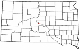
Voir la carte administrative
City locator 14.svg
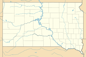
Voir la carte topographique
City locator 14.svg

Fort Pierre est une ville de l’État américain du Dakota du Sud, située dans le comté de Stanley, dont elle est le siège. Selon le recensement de 2010, sa population est de 2 078 habitants. La ville fut fondée par Pierre Chouteau, négociant de fourrure, en 1832.

La région avait déjà été visité par Pierre Gaultier de Varennes et de La Vérendrye au XVIIIe siècle. Un site archéologique, le site de La Vérendrye, présente la fameuse plaque de plomb gravée par La Vérendrye en 1741, lors d'une de ses expéditions exploratoires.

Fort Pierre est située près de l’emplacement où l’expédition Lewis et Clark a rencontré les Teton Sioux.


Wikimedia Foundation. 2010.

Contenu soumis à la licence CC-BY-SA. Source : Article Fort Pierre de Wikipédia en français (auteurs)

Игры ⚽ Поможем написать курсовую

Regardez d'autres dictionnaires:

  • Fort Pierre — Fort Pierre, SD U.S. city in South Dakota Population (2000): 1991 Housing Units (2000): 875 Land area (2000): 2.899696 sq. miles (7.510177 sq. km) Water area (2000): 0.048315 sq. miles (0.125135 sq. km) Total area (2000): 2.948011 sq. miles… …   StarDict's U.S. Gazetteer Places

  • Fort Pierre, SD — U.S. city in South Dakota Population (2000): 1991 Housing Units (2000): 875 Land area (2000): 2.899696 sq. miles (7.510177 sq. km) Water area (2000): 0.048315 sq. miles (0.125135 sq. km) Total area (2000): 2.948011 sq. miles (7.635312 sq. km)… …   StarDict's U.S. Gazetteer Places

  • Fort Pierre — Sp Fòrt Pỹras Ap Fort Pierre L JAV Stanlio apyg. c. (P. Dakota) …   Pasaulio vietovardžiai. Internetinė duomenų bazė

  • Fort Pierre — Original name in latin Fort Pierre Name in other language State code US Continent/City America/Chicago longitude 44.35359 latitude 100.37374 altitude 436 Population 2078 Date 2011 05 14 …   Cities with a population over 1000 database

  • Fort Pierre (Dakota Du Sud) — Fort Pierre Fort Pierre Pays  États Unis État …   Wikipédia en Français

  • Fort Pierre (Dakota du Sud) — Fort Pierre Fort Pierre Pays  États Unis État …   Wikipédia en Français

  • Fort pierre (dakota du sud) — Fort Pierre Fort Pierre Pays  États Unis État …   Wikipédia en Français

  • Fort Pierre Bordes — Pierre Bordes Nom local bordj Coordonnées 19° 57′ 13″ N 2° 58′ 12″ E …   Wikipédia en Français

  • Fort Pierre National Grassland — is a United States National Grassland in central South Dakota, south of the capital, Pierre. It is primarily a short grass prairie. It has a land area of 115,890 acres (181.08 sq mi, or 468.99 km²). In descending order of acreage it lies in parts …   Wikipedia

  • Fort Pierre, South Dakota — Infobox Settlement official name = Fort Pierre, South Dakota other name = native name = nickname = settlement type = City motto = imagesize = image caption = flag size = image seal size = image shield = shield size = image blank emblem = blank… …   Wikipedia

Share the article and excerpts

Direct link
Do a right-click on the link above
and select “Copy Link”