Fasta Åland
- Fasta Åland
-
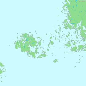
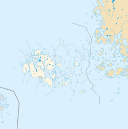
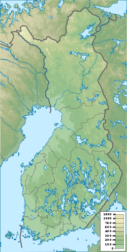
Fasta Åland (Manner-Ahvenanmaa en finnois) est l'île principale de l'archipel et territoire autonome d'Åland et la troisième plus grande île de la Finlande.
Elle mesure environ 50 km dans le sens nord-sud, 45 km dans le sens est-ouest et avec une superficie de 1 010 km2, elle est la plus grande île du golfe de Finlande.
Elle occupe 70 % de la surface du territoire autonome et 90 % des Ålandais vivent sur cette île[1]
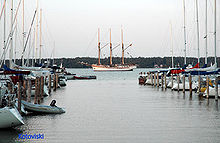
L'île se compose, outre la capitale, Mariehamn, des municipalités suivantes:
Avec 129 m de haut, l'Orrdalsklint est le point culminant de Fasta Åland.
Note
Wikimedia Foundation.
2010.
Contenu soumis à la licence CC-BY-SA. Source : Article Fasta Åland de Wikipédia en français (auteurs)
Regardez d'autres dictionnaires:
Fasta Aland — Fasta Åland Fasta Åland Carte de l archipel d Åland avec Fasta Åland au centre gauche. Géographie Pays … Wikipédia en Français
Fasta Aland — Fasta Åland (finnisch Manner Ahvenanmaa oder Ahvenanmanner) ist die Hauptinsel des Åland Archipels. Genaugenommen handelt es sich um eine Inselgruppe mehrerer großer Inseln, die aber sehr nahe beieinander liegen und mit Brücken verbunden sind. So … Deutsch Wikipedia
Fasta Åland — Vorlage:Infobox Insel/Wartung/Bild fehlt Fasta Åland Gewässer Ostsee Inselgruppe Åland Archipel Geographische Lage … Deutsch Wikipedia
Fasta Åland — Infobox Islands name = Fasta Åland image caption = image size = locator Location map|Finland|lat=60.148056|long=19.788333|width=175|float=center map custom = yes native name = Manner Ahvenanmaa or Ahvenanmanner native name link = Finnish language … Wikipedia
Åland Islands — Åland redirects here. For other uses, see Åland (disambiguation). Åland Islands Landskapet Åland (Ahvenanmaan maakunta) … Wikipedia
Aland — Åland Pour les articles homophones, voir Hollande et Öland. État libre associé d Åland Landskapet Åland (sv) Ahvenanmaan maakunta … Wikipédia en Français
Aland-Inseln — Åland Autonome Provinz Finnlands Flagge Wappen (Details) … Deutsch Wikipedia
Åland-Inseln — Åland Autonome Provinz Finnlands Flagge Wappen (Details) … Deutsch Wikipedia
Åland — Autonome Provinz Finnlands Flagge Wappen (Details) … Deutsch Wikipedia
Aland (disambiguation) — Aland can mean:*Åland, (the Aland Islands ) an archipelago in the Baltic Sea, and a self governing part of Finland *Fasta Åland, ( Mainland Aland ) the main island in the Åland archipelago *Aland (India), a town in the Indian state of Karnataka… … Wikipedia

 Finlande
 Finlande


