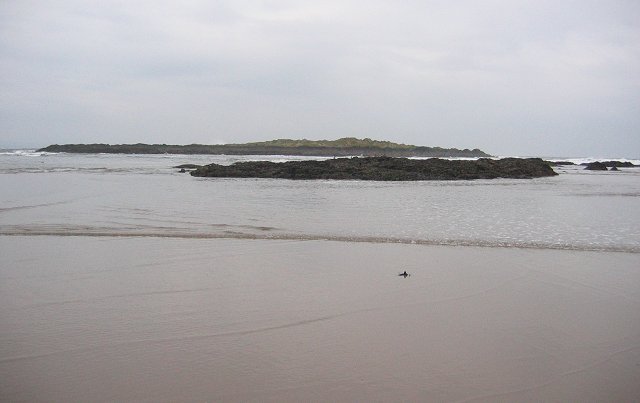
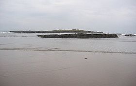
Eyebroughy
Contenu soumis à la licence CC-BY-SA. Source : Article Eyebroughy de Wikipédia en français (auteurs)
Regardez d'autres dictionnaires:
Eyebroughy — (or archaically Ibris;NT493859) is an islet in the Firth of Forth, 200 m off East Lothian, Scotland. It is not far from Gullane and 3 miles (5 km) from North Berwick, and forms part of the parish of Dirleton… … Wikipedia
Eyebroughy — Eyebroughy, con rocas al fondo. Eyebroughy (o arcáicamente Ibris) es un islote localizado en el Firth of Forth, a 200 metros de East Lothian, en Escocia. La isla constituye una reserva de la RSPB, debido a la población de cormoranes que alberga.… … Wikipedia Español
Ibris, or Eyebroughy — IBRIS, or EYEBROUGHY, an isle, in the parish of Dirleton, county of Haddington. This islet lies close to the main land of the parish, in the Frith of Forth, and is of small extent, and very narrow. The isle of Fidrey, also appertaining to… … A Topographical dictionary of Scotland
List of places in East Lothian — The List of places in East Lothian is a list for any town, village, hamlet, castle, golf course, historic house, hillfort, lighthouse, nature reserve, reservoir, river, and other place of interest in East Lothian, Scotland.A* Aberlady and… … Wikipedia
Fiordo de Forth — Saltar a navegación, búsqueda Para otros usos de este término, véase Forth (desambiguación). Fiordo de Forth (Firth of Forth Abhainn Dhubh) … Wikipedia Español
Firth — is the Lowland Scots word used to denote various coastal waters in Scotland. It is usually a large sea bay, which may be part of an estuary, or just an inlet, or even a strait. It is cognate to fjord (both from Proto Germanic *ferþuz) which has a … Wikipedia
Firth of Forth — The Firth of Forth (Scottish Gaelic: Linne Foirthe ) is the estuary or firth of Scotland s River Forth, where it flows into the North Sea between Fife to the north, and West Lothian, the City of Edinburgh, and East Lothian to the south.Geography… … Wikipedia
Bass Rock — Infobox Scottish island | latitude=56.08 longitude= 2.64 GridReference=NT602873 celtic name= norse name= meaning of name=Uncertain area= 3 ha area rank= highest elevation=107 m Population=0 population rank= main settlement= island group=Islands… … Wikipedia
Isle of May — Location … Wikipedia
Craigleith — This article is about the island in the Firth of Forth. For the suburb of Edinburgh, see Craigleith, Edinburgh … Wikipedia
 Royaume-Uni
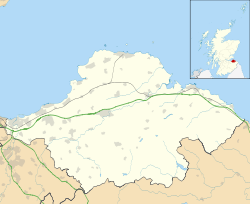
 Eyebroughy