Estahban
- Estahban
-
29° 07′ N 54° 02′ E / 29.12, 54.04
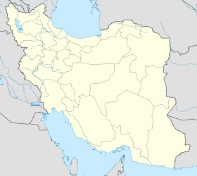
Estahban (en persan : استهبان) est une ville de la province du Fars en Iran, chef-lieu du département du même nom.
La ville s'est appelée Estahbanat (en persan : اصطهبانات) jusque dans les années 1970. Le département est très fertile et produit des céréales, du coton, du tabac et des fruits.
Wikimedia Foundation.
2010.
Contenu soumis à la licence CC-BY-SA. Source : Article Estahban de Wikipédia en français (auteurs)
Regardez d'autres dictionnaires:
Estahban — Infobox Settlement official name = PAGENAME native name = imagesize = image caption = image map caption = pushpin pushpin label position =bottom pushpin mapsize = 300 pushpin map caption =Location in Iran subdivision type = Country subdivision… … Wikipedia
Estahban County — ( fa. شهرستان استهبان) is a county in Fars Province in Iran. The capital of the county is Estahban. Roniz is also a newly established (recently promoted to) town in Estahban County.References* اطلس گیتاشناسی استانهای ایران [Atlas Gitashenasi… … Wikipedia
Shahrestan-e Estahban — Admin ASC 2 Code Orig. name Shahrestān e Estahbān Country and Admin Code IR.07.449575 IR … World countries Adminstrative division ASC I-II
Fars Province — Infobox Iran Province province name = Fars ostan name = فارس loc capital = Shiraz latd = 29.609 longd = 52.532 area = 122,608 population = 4,385,869 pop year = 2005 pop density = 35.8 sub provinces = 23 languages= Persian Qashqai Luri (Mamasani… … Wikipedia
Fasa (Landkreis) — Der Landkreis Fasa (persisch شهرستان فسا) ist ein Landkreis (šahrestān) mit einer Größe von 3820 km² in der iranischen Provinz Fars. Das Verwaltungszentrum befindet sich in der gleichnamigen Stadt Fasa. Weitere größere Städte sind Šešdeh… … Deutsch Wikipedia
List of universities in Iran — This is a list of universities in Iran: See Higher education in Iran, for more information. List of Iran s universities grouped alphabetically [additions at end of list not alphabetized. The Islamic Azad and Payam Nour Universities on the… … Wikipedia
Naqsh-e Rustam — Coordinates: 29°59′20″N 52°52′29″E / 29.98889°N 52.87472°E / 29.98889; 52.87472 Further information: Achaemenid architecture … Wikipedia
Darab — For the administrative subdivision, see Darab County. Darab داراب city … Wikipedia
Marvdasht — For the administrative subdivision, see Marvdasht County. Marvdasht مرودشت city Persepolis … Wikipedia
Ka'ba-ye Zartosht — Cube of Zoroaster (Ka ba ye Zartosht) … Wikipedia

 Iran
Iran
