Elie and Earlsferry
- Elie and Earlsferry
-
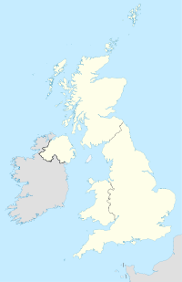
Elie and Earlsferry est une ville et actuel Burgh royal dans le Fife en Écosse, situé dans le East Neuk au nord du Firth of Forth.
Le burgh comprend les deux villages d'Elie et d'Earlsferry qui ont fusionné en 1930 après un décret local : Local Government Act 1929 tout en ayant leurs propres identités historiques. Il s'agit également d'un lieu prisé par les touristes.
Wikimedia Foundation.
2010.
Contenu soumis à la licence CC-BY-SA. Source : Article Elie and Earlsferry de Wikipédia en français (auteurs)
Regardez d'autres dictionnaires:
Elie and Earlsferry — infobox UK placecountry = Scotland official name = Elie and Earlsferry os grid reference = NO4900 map type=Scotland latitude=56.18988 longitude= 2.82334 population = 940 (2004) unitary scotland = Fife lieutenancy scotland = Fife post town = Leven … Wikipedia
Earlsferry — Elie and Earlsferry … Wikipédia en Français
Elie (disambiguation) — Elie is a former village, now part of the town Elie and Earlsferry, in Fife, Scotland.Elie can also mean:* Elie, Manitoba * Elie Wiesel * Élie Ducommun … Wikipedia
Earlsferry — EARLSFERRY, a burgh of regality, in the parish of Kilconquhar, district of St. Andrew s, county of Fife, ½ a mile (W.) from Elie, and 2 miles (S.) from Colinsburgh; containing 496 inhabitants. This place, which is of great antiquity, and… … A Topographical dictionary of Scotland
Royal burgh — A royal burgh was a type of Scottish burgh which had been founded by, or subsequently granted, a royal charter. Although abolished in 1975, the term is still used in many of the former burghs. [http://www.publications.parliament.uk/pa/ld199899/lds… … Wikipedia
List of UK place names with royal patronage — England Regis * Beeston Regis * Bere Regis * Bognor Regis * Grafton Regis * Houghton Regis * Lyme Regis * Melcombe Regis * Milton Regis * Rowley Regis * Wyke Regis Royal * Royal County of Berkshire * Royal Leamington Spa * Royal Tunbridge Wells… … Wikipedia
William Milbourne James — Infobox Military Person name=Sir William Milbourne James lived=22 Dec 1881 17 Aug 1973 placeofbirth=Hartley Wintney, Hampshire placeofdeath=Elie, Fife caption=The five year old James in Bubbles nickname=Bubbles allegiance=United Kingdom… … Wikipedia
King James VI Golf Club — King James VI Golf Club, located in Perth, Scotland, is a private golf course also open to visitors. The River Tay setting is notable as it is the country s only self contained course on a river island. The Island course is only accessible by… … Wikipedia
North-East Fife (district) — Coordinates: 56°19′08″N 3°00′43″W / 56.319°N 3.012°W / 56.319; 3.012 … Wikipedia
Kilconquhar — KILCONQUHAR, a parish, in the district of St. Andrew s, county of Fife; containing, with the port of Earlsferry, the market town of Colinsburgh, and the village of Barnyards, 2605 inhabitants, of whom 334 are in the village of Kilconquhar, 1½… … A Topographical dictionary of Scotland
 Écosse
