Downley
- Downley
-
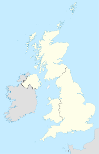
Downley est un village du Buckinghamshire, Angleterre. Le village, situé sur les chilterns, surplombe la ville de High Wycombe au nord-est de celle-ci. Aujourd'hui Downley fait partie de la banlieue de High Wycombe. La population est de 2 244 habitants.
Wikimedia Foundation.
2010.
Contenu soumis à la licence CC-BY-SA. Source : Article Downley de Wikipédia en français (auteurs)
Regardez d'autres dictionnaires:
Downley — Coordinates: 51°38′56″N 0°46′34″W / 51.649°N 0.776°W / 51.649; 0.776 … Wikipedia
High Wycombe — This article is about the town in the United Kingdom. For the suburb of Perth, see High Wycombe, Western Australia. Coordinates: 51°37′43″N 0°44′54″W / 51.628661°N 0.748238 … Wikipedia
Naphill — Coordinates: 51°39′52″N 0°46′28″W / 51.664466°N 0.774488°W / 51.664466; 0.774488 … Wikipedia
List of schools in the South East of England — The following is a partial list of currently operating schools in the South East region of England. You may also find of use to find a particular school. See also the List of the oldest schools in the United Kingdom.Listed by local education… … Wikipedia
Buckinghamshire — For other uses, see Buckinghamshire (disambiguation). Buckinghamshire Flag of Buckinghamshire County Council … Wikipedia
Owlswick — St Peters Chapel … Wikipedia
Monks Risborough — Coordinates: 51°44′04″N 0°49′47″W / 51.734462°N 0.829831°W / 51.734462; 0.829831 … Wikipedia
Princes Risborough — Coordinates: 51°43′26″N 0°50′04″W / 51.723978°N 0.834418°W / 51.723978; 0.834418 … Wikipedia
Marsh, Buckinghamshire — Coordinates: 51°46′19″N 0°49′23″W / 51.772°N 0.823°W / 51.772; 0.823 Marsh is a hamlet in the parish … Wikipedia
Bourne End, Buckinghamshire — Coordinates: 51°34′54″N 0°42′48″W / 51.581737°N 0.713382°W / 51.581737; 0.713382 … Wikipedia
 Angleterre
