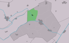
Donkerbroek
Contenu soumis à la licence CC-BY-SA. Source : Article Donkerbroek de Wikipédia en français (auteurs)
Regardez d'autres dictionnaires:
Donkerbroek — Village Country … Wikipedia
Opsterlandse Compagnonsvaart — Opsterlânske Kompanjonsfeart Opsterlânske Kompanjonsfeart Passage du canal à Appelscha Caractéristiques Statut actuel Ouvert à la plaisance Longueur 34 km Mouillage … Wikipédia en Français
Opsterlânske Kompanjonsfeart — Passage du canal à Appelscha Caractéristiques Statut actuel Ouvert à la plaisance Longueur 34 km Mouill … Wikipédia en Français
Ooststellingwerf — Municipality Flag … Wikipedia
List of places in the Netherlands — This is an alphabetical list of places (cities, towns, villages) in the Netherlands. Lists per province can be found at:* List of towns in Groningen * List of towns in Friesland * List of towns in Drente * List of towns in Overijssel * List of… … Wikipedia
Liste der Shared-Space-Projekte — Die Liste der Shared Space Projekte gibt einen Überblick über existierende oder sich im Planungsprozess befindliche Verkehrsanlagen, die der Planungsphilosophie Shared Space entsprechen. Straßenräume können nach Gerlach et al.[1] im engeren Sinn… … Deutsch Wikipedia
Oosterwolde — Gemeinde Ooststellingwerf Flagge Wappen Provinz … Deutsch Wikipedia
Ooststellingwerf — Gemeinde Ooststellingwerf Flagge Wappen Provinz Friesland … Deutsch Wikipedia
Appelscha — 52° 57′ 17″ N 6° 21′ 00″ E / 52.9547, 6.35 … Wikipédia en Français
Elsloo (Frise) — 52°56′34″N 6°14′15″E / 52.94278, 6.2375 … Wikipédia en Français
 Pays-Bas