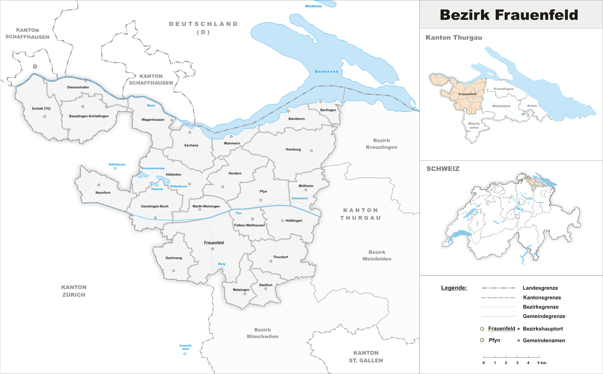
- District de Frauenfeld
-
District de Frauenfeld Pays Suisse Canton Thurgovie Chef-lieu Frauenfeld Superficie 279,59 km² [1] Population:
- Totale (année)
- Densité
60 936 hab. (2009)[2]
217,9 hab/km²Communes 23 N° OFS 2012 Localisation 
Le district de Frauenfeld est un des cinq districts du canton de Thurgovie. Il compte 60 936 habitants pour une superficie de 279,59 km2. Le chef-lieu est Frauenfeld.
Le district compte 23 communes depuis le 1er janvier 2011[3]:
N° OFS Commune Superficie
[km²][1]Population
(décembre 2009)[2]Densité
[hab./km²]4536  Basadingen-Schlattingen
15,64 1 699 108,6 4801  Berlingen
3,56 839 235,7 4545  Diessenhofen
10,12 3 314 327,5 4806  Eschenz
12,01 1 655 137,8 4561  Felben-Wellhausen
7,38 2 394 324,4 4566  Frauenfeld
27,37 22 878 835,9 4571  Gachnang
9,72 3 423 352,2 4811  Herdern
13,67 981 71,8 4816  Homburg
24,15 1 463 60,6 4590  Hüttlingen
11,6 829 71,5 4821  Hüttwilen
17,66 1 450 82,1 4826  Mammern
5,42 584 107,7 4591  Matzingen
7,71 2 530 328,1 4831  Müllheim
8,73 2 629 301,1 4601  Neunforn
11,36 986 86,8 4841  Pfyn
Pfyn13,18 1 933 146,7 4546  Schlatt
15,53 1 601 103,1 4864  Steckborn
8,76 3 461 395,1 4606  Stettfurt
6,36 1 099 172,8 4611  Thundorf
15,61 1 296 83 4616  Uesslingen-Buch
14,01 1 052 75,1 4871  Wagenhausen
11,84 1 603 135,4 4621  Warth-Weiningen
8,2 1 202 146,6 Total : 23 279,59 60 936 217,9 Notes et références
- Statistique de la superficie 2004/09 : Données communales sur Office fédéral de la Statistique. Consulté le 23 septembre 2010
- Bilan de la population résidante permanente (total) selon les districts et les communes, en 2009 sur Office fédéral de la Statistique. Consulté le 1er septembre 2010
- Répertoire officiel des communes de Suisse - Mutations 2010 OFS, décembre 2010
Catégorie :- District du canton de Thurgovie
Wikimedia Foundation. 2010.