Copinsay
- Copinsay
-
Copinsay est une île du Royaume-Uni située en Écosse.
Wikimedia Foundation.
2010.
Contenu soumis à la licence CC-BY-SA. Source : Article Copinsay de Wikipédia en français (auteurs)
Regardez d'autres dictionnaires:
Copinsay — Location … Wikipedia
Copinsay — Blick auf Copinsay von Süden aus. Rechts das „Pferd von Copinsay“ Gewässer Nordsee … Deutsch Wikipedia
Horse of Copinsay — The Horse of Copinsay, also known as the Horse, is a rectangular sea stack to the north east of Copinsay in the Orkney Islands.NameThe Norse were fond of zoomorphising smaller islands for example, smaller islands lying off a larger one are often… … Wikipedia
Corn Holm — seen from Copinsay. Black Holm can be seen beyond it, and in the distance the parish of Deerness on Mainland, Orkney Corn Holm is a small tidal island in Orkney, near Copinsay to the west. There was once a small chapel here [1] , and it is… … Wikipedia
Corn Holm — Pour les articles homonymes, voir Holm. Corn Holm Vue de Corn Holm (deuxième plan) et de Black Holm (troisième plan) … Wikipédia en Français
Pentland Skerries — The Pentland Skerries (Old Norse: Pettlandssker[1]) are a group of four uninhabited islands lying in the Pentland Firth, northeast of Duncansby Head and south of South Ronaldsay in Scotland. By far the largest of the islands is Muckle Skerry,… … Wikipedia
Muckle Skerry — Not to be confused with Muckle Holm. Muckle Skerry is the largest of the Pentland Skerries that lie off the north coast of Scotland. It is home to the Pentland Skerries Lighthouse. Muckle Skerry lies in the Pentland Firth at grid reference… … Wikipedia
List of Orkney islands — This is a list of Orkney islands in Scotland. The Orkney archipelago is located 16 kilometres (10 miles) north of mainland Scotland and comprises over 70 islands and skerries, of which 20 are inhabited. In addition to the Orkney Mainland there… … Wikipedia
Black Holm — is a small tidal island in the Orkneys, near Copinsay to the west of Corn Holm. Geography and geology Corn Holm is made up of red sandstoneHaswell Smith, Hamish. (2004) The Scottish Islands. Edinburgh. Canongate.] .At low tide it is connected to… … Wikipedia
Liste britischer Inseln — Lage der Britischen Inseln Diese Liste führt die wichtigsten der etwa 600 Inseln der Britischen Inseln auf. Politisch sind diese Inseln Teil des Vereinigten Königreiches, der Republik Irland und der Isle of Man, die als Kronbesitz kein… … Deutsch Wikipedia
 Royaume-Uni
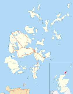
 Copinsay

