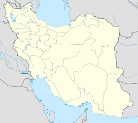
Abhar
- Abhar
-
36° 09′ N 49° 13′ E / 36.15, 49.22
Abhar (en persan : ابهر) est une ville d'Iran située entre Qazvin et Zanjan, dans la province de Qazvin. Sa population était estimée à 72 386 habitants en 2006gazetteer.de.
La ville est un centre scientifique grâce à ses universités: l'Université libre de Abhar, l'université Payam Noor, Sama et d'autres centres culturels et scientifiques. Sa position géographique, sur les routes et chemin de fer reliant Téhéran à Tabriz, lui donne un rôle de ville de transit et a attiré des entreprises comme Minoo, AWC, Medisk, Parsnakh et d'autres.
Lien externe
Wikimedia Foundation.
2010.
Contenu soumis à la licence CC-BY-SA. Source : Article Abhar de Wikipédia en français (auteurs)
Regardez d'autres dictionnaires:
Abhar — Infobox Settlement official name = Abhar native name = imagesize = image caption = image map caption = pushpin pushpin label position =bottom pushpin mapsize = 300 pushpin map caption =Location in Iran subdivision type = Country subdivision type1 … Wikipedia
Abhar — Original name in latin Abhar Name in other language Abhar, Abkhar, aabkhar, abr, Абхар State code IR Continent/City Asia/Tehran longitude 36.1468 latitude 49.218 altitude 1541 Population 69889 Date 2012 01 17 … Cities with a population over 1000 database
Abhar County — ( fa. شهرستان ابهر) is a county in Zanjan Province in Iran. The capital of the county is Abhar.References* اطلس گیتاشناسی استانهای ایران [Atlas Gitashenasi Ostanhai Iran] ( [http://www.gitashenasi.com/En/Product/Index.cfm?I=9 Gitashenasi… … Wikipedia
Abhar River — Abharrood (meaning Abhar s river ) is a river in Iran that runs between Abhar and Qom … Wikipedia
Ibn-i-Abhar — Hájí Mírzá Muhammad Taqí (d.1917) known as Ibn i Abhar ( ar. ابن ابحار), was an eminent follower of Bahá u lláh, the founder of the Bahá í Faith, a global religion of Persian origin. He was appointed a Hand of the Cause, and identified as one of… … Wikipedia
Shahrestan-e Abhar — Admin ASC 2 Code Orig. name Shahrestān e Abhar Country and Admin Code IR.36.449562 IR … World countries Adminstrative division ASC I-II
Soltaniyeh — For the administrative subdivision, see Soltaniyeh District. Soltaniyeh سلطانيه city Soltaniyeh Dome … Wikipedia
List of universities in Iran — This is a list of universities in Iran: See Higher education in Iran, for more information. List of Iran s universities grouped alphabetically [additions at end of list not alphabetized. The Islamic Azad and Payam Nour Universities on the… … Wikipedia
Zanjan Province — Infobox Iran Province province name = Zanjan ostan name = زنجان loc capital = Zanjan latd = 36.6751 longd = 48.4845 area = 21,773 pop = 970,946 pop year = 2005 pop density = 44.6 sub provinces = 7 languages= Azerbaijani, Persian, TatiZanjan ( az … Wikipedia
Molla Hassan Kashi Mausoleum — Molla Hassan Kāshi Mausoleum آرامگاه ملاحسن كاشي Basic information Location … Wikipedia

 Iran
Iran
