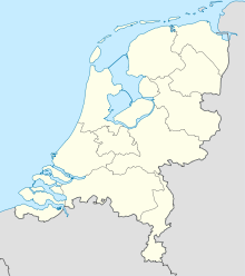
Aarlanderveen
Contenu soumis à la licence CC-BY-SA. Source : Article Aarlanderveen de Wikipédia en français (auteurs)
Regardez d'autres dictionnaires:
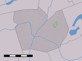
Aarlanderveen — Dutch town locator maps mun town caption = Aarlanderveen in the municipality of Alphen aan den Rijn.Aarlanderveen (coord|52|8|N|4|44|E|type:city(500)) is a town in the Dutch province of South Holland. It is a part of the municipality of Alphen… … Wikipedia
Vrijhoeven — is a former hamlet and former municipality in the Dutch province of South Holland. It is located about 2 km south of the village of Ter Aar.According to the 19th century historian A.J. van der Aa, Vrijhoeven was a part of the heerlijkheid… … Wikipedia
Alphen aan den Rijn — Infobox Settlement official name = Alphen aan den Rijn flag size = 120x100px image shield = Coat of arms of Alphen aan den Rijn.jpg shield size = 120x100px mapsize = 280px subdivision type = Country subdivision name = Netherlands subdivision… … Wikipedia
Liste aller niederländischen Gemeinden A–L — In diese Liste werden alle Gemeinden, die auf dem Gebiet der jetzigen Niederlande bestehen oder bestanden haben, aufgenommen. Die Liste beginnt im Jahr 1805/10. Vor 1830 können die Angaben unvollständig sein. Kleinere Grenzkorrekturen oder… … Deutsch Wikipedia
Wensinck — Arent Jan Wensinck (* 7. August 1882 in Aarlanderveen (seit 1918 zusammengelegt mit Alphen aan den Rijn), Niederlande; † 19. September 1939) war ein niederländischer Islamwissenschaftler, Historiker der Syrischen mystischen Theologie und… … Deutsch Wikipedia
Oudshoorn — 52°08′N 4°40′E / 52.133, 4.667 … Wikipédia en Français
Kinderdijk — Coordinates: 51°53′N 4°38′E / 51.883°N 4.633°E / 51.883; 4.633 … Wikipedia
List of places in the Netherlands — This is an alphabetical list of places (cities, towns, villages) in the Netherlands. Lists per province can be found at:* List of towns in Groningen * List of towns in Friesland * List of towns in Drente * List of towns in Overijssel * List of… … Wikipedia
De Adriaan, Haarlem — Windmill De Adriaan De Adriaan is a windmill in the Netherlands that burnt down in 1932 and was rebuilt in 2002. The original windmill dates from 1779 and the mill has been a distinctive part of the skyline of Haarlem for centuries. Contents … Wikipedia
Abraham Jacob van der Aa — (Amsterdam, 7 December 1792 Gorinchem, 21 March 1857) was a Dutch literator. He was born in Amsterdam in 1792. His father was a lawyer. From the ages of 6 till 12 he visited the dayschool in Amstelveen. After this he was send to the boarding… … Wikipedia

 Pays-Bas