Cinderford
- Cinderford
-
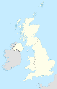
Cinderford est une petite ville anglaise située dans le district de Forest of Dean et le comté du Gloucestershire. En 2001, elle comptabilise 8 116 habitants.
Cinderford est située dans l'est de la Forêt de Dean.
Le nom "Cinderford" remonte à 1258. La ville s'est développée au XIXe siècle grâce à la rapide expansion des mines de charbon. Lorsque ces mines ont cessé leur activité dans les années 1950, la ville a souffert économiquement. En effet, elle ne pouvait pas se rappuyer sur des industries d'un autre type. Aujourd'hui, la ville a une physionomie tout à fait caractéristique, avec de longues rues bordées de bâtiments identiques, très semblable aux villes de vallée du sud du pays de Galles qui se sont également développées à partir de l'industrie minière. Le taux de chômage y est plus élevé que dans les autres villes de la région.
Cinderford compte des équipes de football et de rugby, ayant chacune son propre stade.
Catégories :
- Ville du Gloucestershire
- Toponyme indiquant un gué
Wikimedia Foundation.
2010.
Contenu soumis à la licence CC-BY-SA. Source : Article Cinderford de Wikipédia en français (auteurs)
Regardez d'autres dictionnaires:
Cinderford R.F.C. — Cinderford Full name Cindeford Rugby Football Club Founded 1886 Location Cinderford, Gloucestershire, England Ground(s) Dockham Road (Capacity: 2500) Coach(es) … Wikipedia
Cinderford — Coordinates: 51°49′21″N 2°29′56″W / 51.8225°N 2.4989°W / 51.8225; 2.4989 … Wikipedia
Cinderford — Original name in latin Cinderford Name in other language State code GB Continent/City Europe/London longitude 51.82421 latitude 2.4987 altitude 210 Population 10293 Date 2010 05 24 … Cities with a population over 1000 database
Cinderford Town A.F.C. — Cinderford Town Full name Cinderford Town Association Football Club Nickname(s) The Town or The Foresters Founded 1922 … Wikipedia
Cinderford Ironworks — Coordinates: 51°48′49″N 2°30′31″W / 51.813727°N 2.508579°W / 51.813727; 2.508579 … Wikipedia
Cinderford Town F.C. — Infobox Football club fullname = Cinderford Town Football Club clubname = Cinderford Town nickname=The Town or The Foresters founded = 1922 ground = Causeway Ground Cinderford capacity = 3,500 (250 seated) chairman = Ashley Saunders manager = Lee … Wikipedia
Cinderford Canal — Coordinates: 51°49′55″N 2°30′22″W / 51.832°N 2.506°W / 51.832; 2.506 The Cinderford Canal was a private canal, opened in a … Wikipedia
Forest of Dean — This article is about the historic Forest. For the local authority, which covers a wider area, see Forest of Dean (district). The view north towards Ross on Wye from Symonds Yat Rock, a popular tourist destination in the Forest The Forest of Dean … Wikipedia
National Cycle Route 44 — National Cycle Network, Route 44, part of the National Cycle Network, connects Shrewsbury, Shropshire with Cinderford, Gloucestershire. The part of the route from Shrewsbury to Bromfield is signed the remainder of the route is currently unsigned … Wikipedia
Chris Price — Personal information Full name Christopher John Price[1] Date of birth … Wikipedia