Chaguanas
- Chaguanas
-
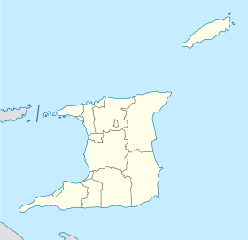
Chaguanas est une ville de Trinité-et-Tobago située sur l'île de Trinité. Elle a le statut de borough. C'est la ville la plus peuplée du pays avec 67 433 habitants en 2000.
Catégories : - Subdivision de Trinité-et-Tobago
- Ville de Trinité-et-Tobago
Wikimedia Foundation.
2010.
Contenu soumis à la licence CC-BY-SA. Source : Article Chaguanas de Wikipédia en français (auteurs)
Regardez d'autres dictionnaires:
Chaguanas — Bandera … Wikipedia Español
Chaguanas — Borough of Chaguanas Chaguanas Borough Coordinates … Wikipedia
Chaguanas — Original name in latin Chaguanas Name in other language State code TT Continent/City America/Port of Spain longitude 10.51667 latitude 61.41667 altitude 18 Population 67433 Date 2010 08 28 … Cities with a population over 1000 database
Chaguanas — Admin ASC 1 Code Orig. name Chaguanas Country and Admin Code TT.CHA TT … World countries Adminstrative division ASC I-II
Presentation College, Chaguanas — is a Roman Catholic secondary school on the corner of Yves and Rene Streets, Chaguanas, Trinidad and Tobago. The land on which the school was built was donated by Endeavour estates. The school was founded by Canon Max Murphy, with the permission… … Wikipedia
Ward of Chaguanas — Admin ASC 2 Code Orig. name Ward of Chaguanas Country and Admin Code TT.02.3574809 TT … World countries Adminstrative division ASC I-II
Trinidad and Tobago local election, 2008 — Local elections are due to be held in Trinidad and Tobago in June 2008. They were originally scheduled for June 2006, but were postponed for a year by Prime Minister Patrick Manning for one year. In June 2007 he delayed them for another year. The … Wikipedia
List of schools in Trinidad and Tobago — Primary SchoolsAssisted schoolsRun by the Anglican Board* Anstey Memorial Girls Anglican School (San Fernando) * Arouca Anglican Primary School * Barataria Anglican Primary School (Barataria) * Coffee Boys Anglican School (San Fernando) * Claxton … Wikipedia
List of Trinidad and Tobago-related topics — This is a list of topics related to Trinidad and Tobago. Those interested in the subject can monitor changes to the pages by clicking on Related changes in the sidebar.Trinidad and Tobago* Trinidad and Tobago * [http://www.trinilocal.com Trinidad … Wikipedia
Trinidad and Tobago general election, 2007 — General elections were held in Trinidad and Tobago on 5 November, 2007. [cite web |url=http://www.iht.com/articles/ap/2007/09/28/news/CB GEN Trinidad Elections.php |title=Trinidad PM announces Nov. 5 elections |accessdate=2007 11 06… … Wikipedia

 Trinité-et-Tobago


