Bulloo
Contenu soumis à la licence CC-BY-SA. Source : Article Bulloo de Wikipédia en français (auteurs)
Regardez d'autres dictionnaires:
Bulloo — Admin ASC 2 Code Orig. name Bulloo Country and Admin Code AU.04.31750 AU … World countries Adminstrative division ASC I-II
Bulloo — /ˈbʊlu/ (say boolooh) noun a river in south western Qld, rising in the northern part of the Grey Range and flowing into Lake Bulloo. 470 km …
Bulloo River — Infobox River river name = Bulloo River origin = Grey Range, western Queensland (Idalia National Park) mouth = Bulloo Lake (ephemeral) basin countries = Australia length = 1580 km (981 mi) elevation = 290m (2600 ft) at source discharge = 20 m³/s… … Wikipedia
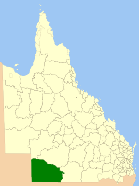
Bulloo Shire Council — Infobox Australian Place | type = lga name = Bulloo Shire Council state = qld imagesize= 180 caption = Location in Queensland pop = 724 area = 74000 est = seat = Thargomindah mayor = John Ferguson region = url = http://www.bullooshire.net.au/… … Wikipedia
Comte de Bulloo — Comté de Bulloo Comté de Bulloo Géographie État … Wikipédia en Français
Comté De Bulloo — Géographie État … Wikipédia en Français
Comté de bulloo — Géographie État … Wikipédia en Français
Comté de Bulloo — 27°40′16.91″S 142°24′17.14″E / 27.6713639, 142.4047611 … Wikipédia en Français
Burke and Wills expedition — Map of the Burke and Wills expedition In 1860–61, Robert O Hara Burke and William John Wills led an expedition of 19 men with the intention of crossing Australia from Melbourne in the south to the Gulf of Carpentaria in the north, a distance of… … Wikipedia
Ludwig Becker — For the aviator, see Ludwig Becker (pilot). Dr Ludwig Becker (1808 – 29 April 1861) was an Australian artist, explorer and naturalist born in Darmstadt, Germany. He was a member of the ill fated Burke and Wills expedition and died, along with his … Wikipedia
 Australie
 Portail de l’Australie