Bradda
Contenu soumis à la licence CC-BY-SA. Source : Article Bradda de Wikipédia en français (auteurs)
Regardez d'autres dictionnaires:
brädda — • mätta, saturera, impregnera, brädda, råga … Svensk synonymlexikon
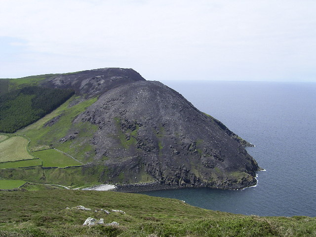
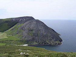
Bradda (colline) — Bradda La colline de Bradda en 2007. Géographie Altitude 230 m Mas … Wikipédia en Français
Bradda (Colline) — 54° 06′ 14″ N 4° 45′ 55″ W / 54.10396, 4.76533 … Wikipédia en Français
Bradda Head — is a rugged headland in the south west of the Isle of Man, in the British Isles, rising to a height of 382 feet. There is a clifftop walk, the Coronation Footpath, up to the head and around the head via Milners Tower. This was built in 1871 as a… … Wikipedia
Bradda Hill — Infobox Mountain Name = Bradda Hill Photo = Bradda Hill.jpg Caption = Bradda Hill from the north after a gorse fire Elevation = 230 m (755 ft) Location = Isle of Man Range = Prominence = c. 205 m Coordinates = Topographic OS Landranger 95 Type =… … Wikipedia
Port Erin — Purt Chiarn (gv) Vue aérienne de Port Erin … Wikipédia en Français
Port Erin — infobox UK place crown dependency = Isle of Man official name= Port Erin manx name= Purt Chiarn latitude= 54.085 longitude= 4.755 population = 3,369 (2001 Census) manx parish= Rushen manx shedding= Rushen constituency manx parliament= Rushen post … Wikipedia
Geography of the Isle of Man — Isle of Man Native name: Ellan Vannin Topographic map of the Isle of Man … Wikipedia
Isle of Man Railway — The Isle of Man Railway (IMR) is a narrow gauge steam operated railway connecting Douglas with Castletown and Port Erin on the Isle of Man. The line is built to RailGauge|36 gauge track and is 15.3 miles (24.6 km) long. It is part of what was a… … Wikipedia
Islands of the Isle of Man — The Isle of Man ( gv. Ellan Vannin) is a Crown dependency in the centre of the Irish Sea. It is not part of the United Kingdom, European Union or United Nations. There are several islands in the Irish Sea that are part of the administrative… … Wikipedia
 Île de Man
 Portail de l’île de Man
 Portail de la montagne