Yeavering
- Yeavering
-
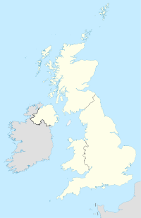
Yeavering est un petit hameau dans le coin nord-est de la paroisse civile de Kirknewton dans le comté anglais de Northumberland. Il est sur la rivière Glen à la limite nord des Monts Cheviot.
Wikimedia Foundation.
2010.
Contenu soumis à la licence CC-BY-SA. Source : Article Yeavering de Wikipédia en français (auteurs)
Regardez d'autres dictionnaires:
Yeavering — is a very small hamlet in the north east corner of the civil parish of Kirknewton in the English county of Northumberland. It is located at latitude 55° 34’ longitude 2° 07’, on the River Glen at the northern edge of the Cheviot Hills.According… … Wikipedia
Yeavering Bell — The Yeavering Bell is a twin peaked hill near the River Glen in Northumberland, England. The hill, 361 metres above sea level, is encircled by the wall of a late prehistoric hillfort, a tribal centre of the Votadini.ee also* History of… … Wikipedia
Battle of Yeavering — The Battle of Yeavering (or Battle of Geteryne) was fought on July 22, 1415 between English and Scottish forces near Yeavering in Northumberland. A small English force consisting of 440 men led by the Earl of Westmoreland defeated 4,000 Scots.… … Wikipedia
Иверинг — (Yeavering), резиденция королей Нортумбрии с начала 7 в. до 680 г., расположена в Северном Нортумберленде. В центре находятся несколько больших бревенчатых зданий, а также сооружение, истолкованное как место собраний. Одна из построек меньших … Археологический словарь
River Glen, Northumberland — The River Glen in Northumberland, England is a tributary of the River Till. The College Burn and Bowmont Water, both flowing out of the Cheviot Hills, meet near Kirknewton to form the River Glen. The Glen flows past the small settlements of… … Wikipedia
Edwin of Northumbria — Infobox Monarch name =St Edwin of Northumbria title =King of Deira and Bernicia caption =Imaginary depiction of Edwin from John Speed s 1611 Saxon Heptarchy . reign =616 12 October 633 coronation = othertitles = full name = predecessor… … Wikipedia
Milfield — See also: Millfield (disambiguation) Coordinates: 55°35′42″N 2°06′17″W / 55.5950°N 2.1047°W / 55.5950; 2.1047 … Wikipedia
Battle of Humbleton Hill — Infobox Military Conflict conflict=Battle of Humbleton Hill caption= partof= date=September 14 1402 place=Wooler, Northumberland, England result=Decisive English Victory combatant1=Scots combatant2=English commander1=Archibald Douglas, 4th Earl… … Wikipedia
Brian Hope-Taylor — Dr Brian Hope Taylor (b. Surrey, 21 October 1923 Cambridge, 12 January 2001) was an artist, archeologist, broadcaster and university lecturer, who made a significant contribution to the understanding of early British history. Professional career… … Wikipedia
Angelsächsische Mythologie — Die angelsächsische Religion bezieht sich auf die vorchristliche polytheistische Religion des germanischen Sammelvolks der Angelsachsen in England und wird als Bestandteil der germanischen Religion insgesamt, sowie im besonderen der kontinentalen … Deutsch Wikipedia
 Angleterre
