Wingmore
- Wingmore
-
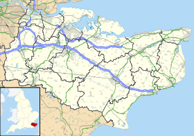
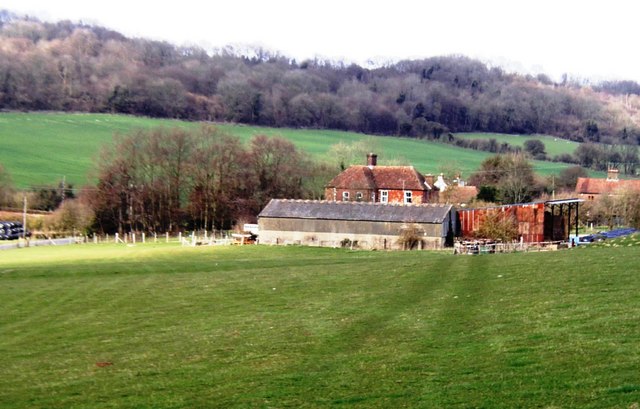
Wingmore est un village situé entre Canterbury et Folkestone dans le district de Shepway dans le Kent, en Angleterre. Il est situé dans la Vallée de Elham a mi-chemin entre les villages de Elham et Barham sur la B2065. Il se compose de quelques chalets et de fermes.
Wikimedia Foundation.
2010.
Contenu soumis à la licence CC-BY-SA. Source : Article Wingmore de Wikipédia en français (auteurs)
Regardez d'autres dictionnaires:
Wingmore — infobox UK place country = England static static image caption=Wingmore Court Farm latitude= 51.175 longitude=1.13 official name=Wingmore population = shire district= Shepway shire county = Kent region= South East England constituency westminster … Wikipedia
New Romney — For the former parliamentary borough, see New Romney (UK Parliament constituency). Coordinates: 50°59′06″N 0°56′28″E / 50.985°N 0.941°E / … Wikipedia
Dungeness (headland) — This article is about the headland in Kent, England. For the spit in Washington, United States, see Dungeness Spit. For the headland on the border of Chile and Argentina, see Punta Dúngeness. Coordinates: 50°55′00″N 0°58′00″E / … Wikipedia
Dymchurch — Coordinates: 51°01′37″N 1°00′00″E / 51.027°N 1.00°E / 51.027; 1.00 … Wikipedia
Hawkinge — For the steamship, see SS Hawkinge. Coordinates: 51°07′01″N 1°09′50″E / 51.117°N 1.1638°E / 51.117; 1.1638 … Wikipedia
Cheriton, Kent — Coordinates: 51°05′17″N 1°08′31″E / 51.088°N 1.142°E / 51.088; 1.142 … Wikipedia
Westenhanger — Coordinates: 51°05′27″N 1°02′15″E / 51.0909°N 1.0375°E / 51.0909; 1.0375 … Wikipedia
Denge — The acoustic mirrors at Denge. Left to right, the 200 foot, 20 foot and 30 foot mirrors. Denge is a former Royal Air Force site near Dungeness, in Kent, England. It is best known for the early experimental acoustic mirrors which remain there. The … Wikipedia
Newington, Shepway — See Newington for other places of that name Coordinates: 51°05′31″N 1°06′52″E / 51.092°N 1.1144°E / 51.092; 1.1144 … Wikipedia
Densole — Coordinates: 51°07′56″N 1°09′35″E / 51.1322°N 1.1598°E / 51.1322; 1.1598 … Wikipedia
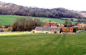 une ferme à Wingmore
 Royaume-Uni
 Wingmore