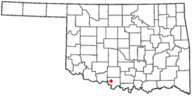
Waurika
- Waurika
-
Wikimedia Foundation.
2010.
Contenu soumis à la licence CC-BY-SA. Source : Article Waurika de Wikipédia en français (auteurs)
Regardez d'autres dictionnaires:
Waurika — Waurika, OK U.S. city in Oklahoma Population (2000): 1988 Housing Units (2000): 929 Land area (2000): 11.831130 sq. miles (30.642484 sq. km) Water area (2000): 0.010455 sq. miles (0.027079 sq. km) Total area (2000): 11.841585 sq. miles (30.669563 … StarDict's U.S. Gazetteer Places
Waurika, OK — U.S. city in Oklahoma Population (2000): 1988 Housing Units (2000): 929 Land area (2000): 11.831130 sq. miles (30.642484 sq. km) Water area (2000): 0.010455 sq. miles (0.027079 sq. km) Total area (2000): 11.841585 sq. miles (30.669563 sq. km)… … StarDict's U.S. Gazetteer Places
Waurika — Original name in latin Waurika Name in other language State code US Continent/City America/Chicago longitude 34.16704 latitude 97.99754 altitude 277 Population 2064 Date 2011 05 14 … Cities with a population over 1000 database
Waurika — Sp Vorikà Ap Waurika L JAV Džefersono apyg. c., ež. (Oklahoma) … Pasaulio vietovardžiai. Internetinė duomenų bazė
Waurika (Oklahoma) — Waurika Ciudad de los Estados Unidos Ubicación en el condado de Jefferso … Wikipedia Español
Waurika, Oklahoma — Infobox Settlement official name = Waurika, Oklahoma settlement type = City nickname = motto = imagesize = image caption = image mapsize = 250px map caption = Location of Waurika, Oklahoma mapsize1 = map caption1 = subdivision type = Country… … Wikipedia
73573 — Waurika, Ok (Miscellaneous » ZIP Codes) … Abbreviations dictionary
Oklahoma State Highway 32 — State Highway 32 Route information … Wikipedia
Jefferson County, Oklahoma — Location in the state of Oklahoma … Wikipedia
National Register of Historic Places listings in Jefferson County, Oklahoma — Location of Jefferson County in Oklahoma This is a list of the National Register of Historic Places listings in Jefferson County, Oklahoma. This is intended to be a complete list of the properties on the National Register of Historic Places in… … Wikipedia
 États-Unis
 Oklahoma