Vršatské Podhradie

Vršatské Podhradie
Vršatské Podhradie
(Village)
Administration
Pays Drapeau de Slovaquie Slovaquie
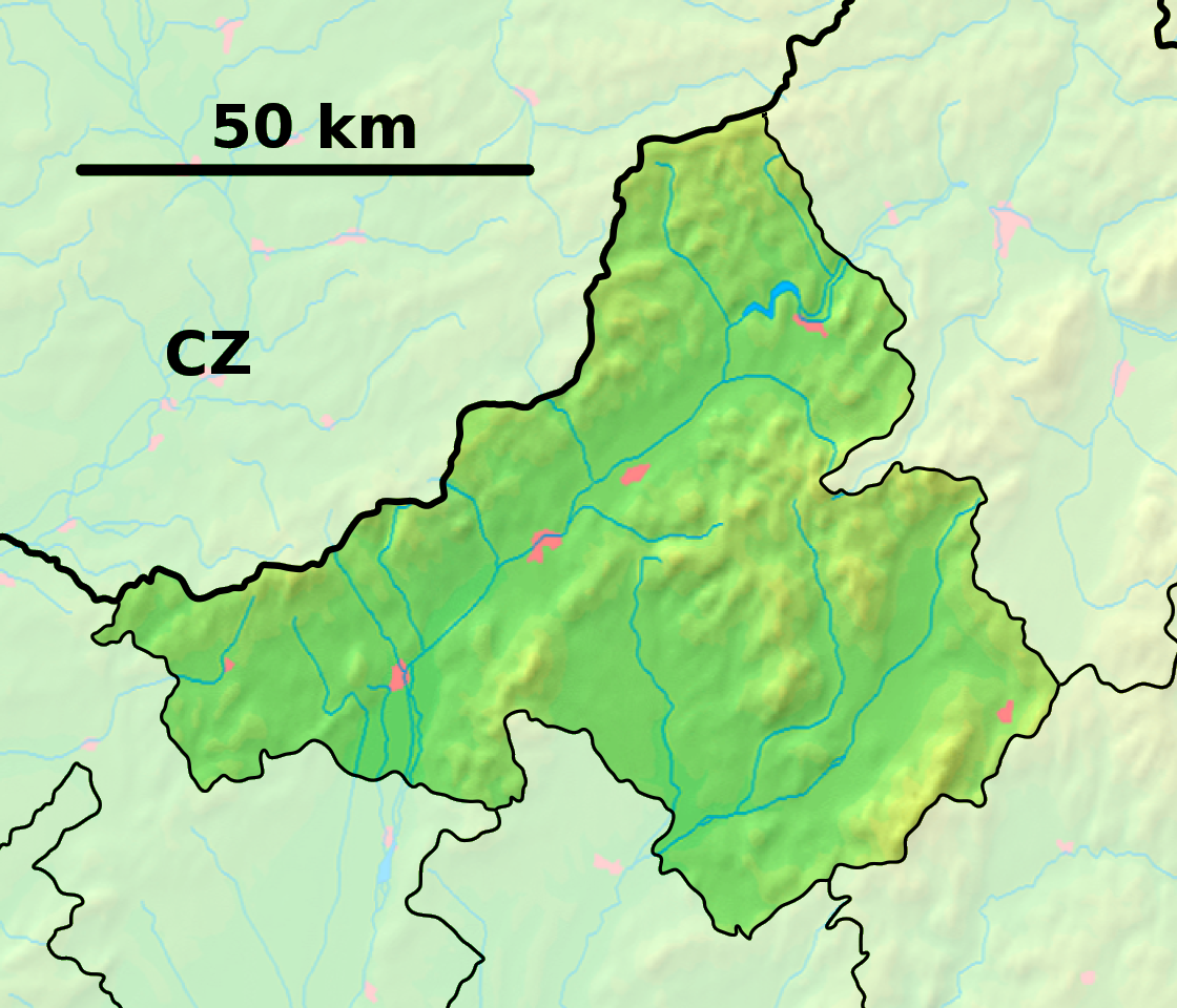
Région Région de Trenčín
District District de Ilava
Code postal 018 52
Plaque minéralogique IL
Starosta (maire) Pavol Husár ( ĽS-HZDS )

Mandat: 2013

Démographie
Population 254 hab. (31.12.2008)
Densité 18,9 hab./km2
Géographie
Coordonnées 49° 04′ 00″ Nord
       18° 09′ 00″ Est
/ 49.066667, 18.15
Altitude 659 m
Superficie 1 343,0618 ha = 13,430618 km²
Localisation en Slovaquie
Voir la carte physique
Localisation de la ville
Vršatské Podhradie
Voir la carte administrative
Localisation de la ville
Vršatské Podhradie
Localisation dans la région de Trenčín
Voir la carte physique
Localisation de la ville
Vršatské Podhradie
Voir la carte administrative
Localisation de la ville
Vršatské Podhradie
Sources
Resultat des élections
http://www.e-obce.sk [1]
http://www.statistics.sk [2]
http://www.slovakregion.sk/ [3]


Vršatské Podhradie (allemand : Löwenstein, hongrois : Oroszlánkő)[4] est un village de Slovaquie situé dans la région de Trenčín.

Histoire

La première mention écrite du village date de 1439[2].

Notes et références

  1. (sk) e-obce.sk. Consulté le 22 février 2010
  2. a et b (sk) (en) Mestská a obecná štatistika SR. Consulté le 22 février 2010
  3. (sk) Slovak region. Consulté le 22 février 2010
  4. (sk) Slovenské slovníky. Consulté le 15 février 2010


Wikimedia Foundation. 2010.

Contenu soumis à la licence CC-BY-SA. Source : Article Vršatské Podhradie de Wikipédia en français (auteurs)

Игры ⚽ Нужно сделать НИР?

Regardez d'autres dictionnaires:

  • Vršatské Podhradie — is a village and municipality in Ilava District in the Trenčín Region of north western Slovakia.HistoryIn historical records the village was first mentioned in 1439.GeographyThe municipality lies at an altitude of 650 metres and covers an area of …   Wikipedia

  • Košecké Podhradie — (Village) Administration Pays  Slovaquie …   Wikipédia en Français

  • Pruske — Pruské Wappen Karte …   Deutsch Wikipedia

  • Pruské — Wappen Karte …   Deutsch Wikipedia

  • List of municipalities and towns in Slovakia — Slovakia This is a comprehensive list of municipalities and towns in Slovakia. For lists of towns and municipalities sorted by Regions see the individual articles on Regions. For an outdated list of towns only in Slovakia see also List of towns… …   Wikipedia

  • Liste der Städte und Gemeinden in der Slowakei/S-Ž — Übersicht S bis Ž Teil 1 A bis G Teil 2 H bis Ľ Teil 3 M bis R Teil 4 S bis Ž Übersicht S Š T Ť U V Z Ž S …   Deutsch Wikipedia

  • Liste der Städte und Gemeinden in der Slowakei Teil 4 — Übersicht S bis Ž Teil 1 A bis G Teil 2 H bis Ľ Teil 3 M bis R Teil 4 S bis Ž Übersicht S Š T Ť U V Z Ž S …   Deutsch Wikipedia

  • Trenčín Region — Geobox | Region name = Trenčín other name = category = Region image caption = image caption = symbol = Trencin coat of arms.gif symbol type = Coat of arms etymology = official name = motto = nickname = country = Slovakia country state = region =… …   Wikipedia

  • Liste deutscher Bezeichnungen slowakischer Orte — In dieser Liste werden slowakischen Orten (Städte, Flüsse, Gebirge, etc.) deren deutsche Bezeichnungen gegenübergestellt, die sie aus deutschsprachiger Sicht heute noch tragen oder zu Zeiten trugen, als die Gebiete zur Donaumonarchie gehörten.… …   Deutsch Wikipedia

  • Dubnica nad Váhom — Coordinates: 48°57′38″N 18°10′26″E / 48.96056°N 18.17389°E / 48.96056; 18.17389 …   Wikipedia

Share the article and excerpts

Direct link
Do a right-click on the link above
and select “Copy Link”