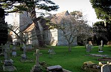
Upper Hardres
Contenu soumis à la licence CC-BY-SA. Source : Article Upper Hardres de Wikipédia en français (auteurs)
Regardez d'autres dictionnaires:
Upper Hardres — infobox UK place country = England official name= Upper Hardres latitude= 51.2355longitude= 1.0809population = 389 [ [http://www.neighbourhood.statistics.gov.uk/dissemination/LeadTableView.do?a=3 b=795422 c=upper+hardres d=16 e=15 g=457147… … Wikipedia
Lower Hardres — infobox UK place country = England official name= Lower Hardres latitude= 51.2355 longitude= 1.0809population = 557 [ [http://www.neighbourhood.statistics.gov.uk/dissemination/LeadTableView.do?a=3 b=795417 c=lower+hardres d=16 e=15 g=457143… … Wikipedia
City of Canterbury — For the settlement within the City of Canterbury, see Canterbury. For the local government area in Australia, see City of Canterbury (New South Wales). City of Canterbury Non metropolitan district, Borough, City … Wikipedia
Chartham — Coordinates: 51°15′18″N 1°01′14″E / 51.255°N 1.0205°E / 51.255; 1.0205 … Wikipedia
Canterbury — For the larger local government district, see City of Canterbury. For other uses, see Canterbury (disambiguation). Coordinates: 51°16′30″N 1°05′13″E / 51.275°N 1.0 … Wikipedia
Chartham Hatch — Coordinates: 51°15′18″N 1°01′14″E / 51.255°N 1.0205°E / 51.255; 1.0205 … Wikipedia
Marshside, Kent — Coordinates: 51°21′03″N 1°11′35″E / 51.3508°N 1.1931°E / 51.3508; 1.1931 … Wikipedia
Chislet — Coordinates: 51°20′11″N 1°11′28″E / 51.336330°N 1.191000°E / 51.336330; 1.191000 … Wikipedia
Chestfield — Coordinates: 51°21′18″N 1°03′50″E / 51.355°N 1.064°E / 51.355; 1.064 … Wikipedia
Hoath — Coordinates: 51°20′00″N 1°09′27″E / 51.3334°N 1.1576°E / 51.3334; 1.1576 … Wikipedia

