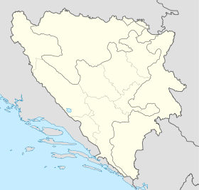
Suhodol
Contenu soumis à la licence CC-BY-SA. Source : Article Suhodol de Wikipédia en français (auteurs)
Regardez d'autres dictionnaires:
suh — sȗh prid. <odr. ī, komp. sȕšī> DEFINICIJA 1. a. koji ne sadrži vlagu, bez vlažnosti [suho rublje] b. koji je bez vode ili oborina [suho ljeto] 2. a. sasušen [suho stablo; suho voće] b. uveo [suho cvijeće] 3. pren. a. suzdržan, hladan [suh… … Hrvatski jezični portal
Donji Vakuf — 44° 08′ 37″ N 17° 24′ 00″ E / 44.1436, 17.4000 … Wikipédia en Français
Burgas Province — Infobox Province of Bulgaria Cyrillic = Област Бургас Capital = Burgas Municipalities = 13 Area = 7,748 km² Population = 457,750 GRAO Density = 54 persons/km² LicensePlate = A, and AA since 2008 Governor = Lyubomir Panteleev Website =… … Wikipedia
Pirin — The Pirin Mountains ( bg. Пирин) are a mountain range in southwestern Bulgaria, with Vihren (2,914 m high) the highest peak, situated at coord|41|45|50|N|23|25|30|E|. The range extends about 40 km northwest southeast, and about 25 km wide. Most… … Wikipedia
Donji Vakuf — Доњи Вакуф Municipality and town Location of Donji Vakuf within Bosnia and Herzegovina … Wikipedia
List of mountains in Bulgaria — Musala Peak, Rila The … Wikipedia
Debelt — is a village in Sredets municipality in Burgas Province in southeastern Bulgaria, about 25 kilometers from Burgas. It has a population of 1,574 and an altitude of 46 meters. The village was founded around the 2nd century by the Roman emperor… … Wikipedia
Polezhan — Infobox Mountain Name = Polezhan Photo = Polezhan01.jpg Caption = Polezhan peak as viewed from the saddle next to Bezbog peak. Elevation = 2,851 metres (9,354 feet) Location = Blagoevgrad Region, Bulgaria Range = Pirin Coordinates =… … Wikipedia
List of settlements in Bosnia and Herzegovina — This is a complete list of settlements in Bosnia and Herzegovina, as recorded by 1991 census, sorted by municipalities. Town of Sarajevo = Sarajevo Centar = • Mrkovići • Nahorevo• Poljine• Radava• Sarajevo (part of settlement)• Vića Sarajevo… … Wikipedia
List of settlements in the Federation of Bosnia and Herzegovina/S — Sa Sabljari Bugojno, Sadovače Vitez (BiH), Sandžak Donji Vakuf, Sanski Most, Sažići Travnik, Se Seoca, Seonica, Sebešić Novi Travnik, Sečevo Travnik, Sedlari, Seferi Travnik, Seferovići Bugojno, Seferovići Uskoplje, Selići Travnik, Selakovići… … Wikipedia
 Bosnie-Herzégovine
 Fédération de Bosnie-et-Herzégovine
