Petkovići

Petkovići

44° 08′ 52″ N 17° 29′ 50″ E / 44.1478, 17.4972

Petkovići
Петковићи
Administration
Pays Drapeau de Bosnie-Herzégovine Bosnie-Herzégovine
Entité Drapeau de la Fédération de Bosnie-et-Herzégovine Fédération de Bosnie-et-Herzégovine
Canton Bosnie centrale
Municipalité Donji Vakuf
Géographie
Coordonnées 44° 08′ 52″ Nord
       17° 29′ 50″ Est
/ 44.1478, 17.4972
Démographie
Population 34 hab. (1991)
Localisation
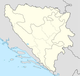
Bosnia and Herzegovina location map.svg
City locator 15.svg
Petkovići

Petkovići (en serbe cyrillique : Петковићи) est un village de Bosnie-Herzégovine. Il est situé dans la municipalité de Donji Vakuf et dans le canton de Bosnie centrale, Fédération de Bosnie-et-Herzégovine. Au recensement de 1991, il comptait 34 habitants, tous serbes[1].

Sommaire

Notes et références

  1. (bs)(hr)(sr) Livre : Composition nationale de la population - Résultats de la République par municipalités et localités 1991, Bulletin statistique n°234, Publication de l'Institut national de statistique de Bosnie-Herzégovine, Sarajevo.

Voir aussi

Articles connexes

Liens externes


Wikimedia Foundation. 2010.

Contenu soumis à la licence CC-BY-SA. Source : Article Petkovići de Wikipédia en français (auteurs)

Игры ⚽ Нужно решить контрольную?

Regardez d'autres dictionnaires:

  • Srebrenica massacre — Srebrenica genocide Part of Bosnian War The cemetery at the Srebrenica Potočari Memorial and C …   Wikipedia

  • Mass executions in the Srebrenica massacre — The Srebrenica Massacre was the July 1995 killing of an estimated 8,000 Bosniak males, in the region of Srebrenica in Bosnia and Herzegovina by units of the Army of Republika Srpska (VRS) under the command of General Ratko Mladić during the… …   Wikipedia

  • Donji Vakuf — 44° 08′ 37″ N 17° 24′ 00″ E / 44.1436, 17.4000 …   Wikipédia en Français

  • Donji Vakuf — Доњи Вакуф   Municipality and town   Location of Donji Vakuf within Bosnia and Herzegovina …   Wikipedia

  • List of settlements in Bosnia and Herzegovina — This is a complete list of settlements in Bosnia and Herzegovina, as recorded by 1991 census, sorted by municipalities. Town of Sarajevo = Sarajevo Centar = • Mrkovići • Nahorevo• Poljine• Radava• Sarajevo (part of settlement)• Vića Sarajevo… …   Wikipedia

  • Donja Borina — Location of the Mali Zvornik municipality in Serbia Donja Borina (Доња Борина) is a village in Serbia. It is situated in the Mali Zvornik municipality, in the Mačva District of Central Serbia. The village has a Serb ethnic majority and its… …   Wikipedia

  • Donji Vakuf — Доњи Вакуф Hilfe zu Wappen …   Deutsch Wikipedia

  • Sapna (Fluss) — Die Sapna ist ein ca. 23 km langer Fluss in Bosnien und Herzegowina. Ihre zwei Quellflüsse Munjača und Rožaljka entspringen im Gebirge Majevica. Sie mündet bei der Stadt Karakaj in den Fluss Drina. Sie fließt durch die Föderation Bosnien und… …   Deutsch Wikipedia

  • Donja Borina — Доња Борина Administration Pays  Serbie …   Wikipédia en Français

  • Velika Reka — Pour un village kosovar, voir Velika Reka (Podujevo). Pour un autre village kosovar, voir Velika Reka (Vučitrn). Velika Reka Велика Река …   Wikipédia en Français

Share the article and excerpts

Direct link
Do a right-click on the link above
and select “Copy Link”