Studenec (district Levoča)
- Studenec (district Levoča)
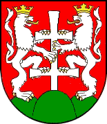
-
Studenec (allemand : Kohlbach in der Zips) est un village de Slovaquie situé dans la région de Prešov.
Histoire
Première mention écrite du village en 1264.
Notes et références
Catégories :
- Village de Slovaquie
- Village et ville du district de Levoča
Wikimedia Foundation.
2010.
Contenu soumis à la licence CC-BY-SA. Source : Article Studenec (district Levoča) de Wikipédia en français (auteurs)
Regardez d'autres dictionnaires:
Doľany (district Levoča) — Doľany (Village) Administration Pays Slovaquie … Wikipédia en Français
Dúbrava (district Levoča) — Pour les articles homonymes, voir Dúbrava. Dúbrava (Village) Administration Pays … Wikipédia en Français
Lúčka (district Levoča) — Lúčka (Village) Administration Pays Slovaquie … Wikipédia en Français
Levoča — (Chef lieu de district) Héraldique … Wikipédia en Français
Levoča District — District Country Slovakia Region (k … Wikipedia
District de Levoča — Levoča Informations Pays … Wikipédia en Français
Studenec — is a village and municipality in Levoča District in the Prešov Region of central eastern Slovakia.HistoryIn historical records the village was first mentioned in 1264.GeographyThe municipality lies at an altitude of 460 metres and covers an area… … Wikipedia
Doľany, Levoča District — Location of Levoča District in the Prešov Region Doľany is a village and municipality in Levoča District in the Prešov Region of central eastern Slovakia. History In historical records the village was first mentioned in … Wikipedia
Dúbrava, Levoča District — Location of Levoča District in the Prešov Region Dúbrava is a village and municipality in Levoča District in the Prešov Region of central eastern Slovakia. History In historical records the village was first mentioned in … Wikipedia
Prešov Region — Geobox | Region name = Prešov category = Region image caption = image caption = symbol = symbol type = etymology = official name = motto = nickname = country = Slovakia country state = region = district = commune = municipality = border = part… … Wikipedia
 Slovaquie
 Studenec