Shimbiris
- Shimbiris
-
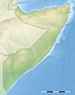
Le Shimbiris (parfois Shimbir Beris[1]) est le point culminant de la Somalie, avec une altitude de 2 416 m[2]. Il est situé dans le Nord du pays, à proximité du golfe d'Aden, non loin d'Erigavo (Ceerigaabo), dans les monts Surud, également appelés Surud Cad ou Surud Ad.
Alors que le reste du pays est généralement doté d'un climat désertique, la région du Shimbiris bénéficie de précipitations plus importantes (700 mm par an), propices à une végétation diversifiée[3].
Notes et références
- ↑ Shimbir Beris pourrait désigner « le lieu des oiseaux », car shimbir est un mot somali qui signifie « oiseau », selon Mohamed Diriye Abdullahi, Parlons Somali, L'Harmattan, Paris, 1996, p. 356 (ISBN 2-7384-4898-4)
- ↑ Le Shimbiris est traditionnellement crédité d'une altitude de 2 416 m, mais d'autres sources indiquent 2 450 m, par exemple The Geology of Somalia: a Selected Bibliography of Somalian Geology, Geography and Earth Science (2007), p. 11 [1]
- ↑ (en) « Surud Mountain Forest in Somaliland : A Cry for Help », Plant Talk, no 36, mai 2004 [2]
Voir aussi
Article connexe
Catégories :
- Sommet d'Afrique
- Montagne de Somalie
- Point culminant d'un pays
Wikimedia Foundation.
2010.
Contenu soumis à la licence CC-BY-SA. Source : Article Shimbiris de Wikipédia en français (auteurs)
Regardez d'autres dictionnaires:
Shimbiris — Bild gesucht BWf1 Höhe 2.450 … Deutsch Wikipedia
Shimbiris — Infobox Mountain Name = Shimbiris Photo = Photo size = Caption = Elevation = convert|2450|m|ft|abbr=on Location = flag|Somalia pushpin pushpin label position = bottom pushpin map caption = Location of Shimbiris in Somalia pushpin mapsize = 200… … Wikipedia
Shimber Berris — f1 Shimbiris Höhe 2.450 m Lage Somalia, Ostafrika Geographische Lage … Deutsch Wikipedia
Shimbir Beris — f1 Shimbiris Höhe 2.450 m Lage Somalia, Ostafrika Geographische Lage … Deutsch Wikipedia
Shimbir Berris — f1 Shimbiris Höhe 2.450 m Lage Somalia, Ostafrika Geographische Lage … Deutsch Wikipedia
Geografie Somalias — Satellitenaufnahme Somalias Die Geographie Somalias ist die Geographie des östlichsten Landes Afrikas. Somalia erstreckt sich über eine Fläche von 637.657 km² und besteht größtenteils in Wüste. Höchste Erhebung ist der Shimbiris (2.450 m).… … Deutsch Wikipedia
Somalia — Somali Republic Jamhuuriyadda Soomaaliya جمهورية الصومال Jumhūriyyat as Sūmāl … Wikipedia
Somaliland — For other uses, see Somaliland (disambiguation). Somaliland locally known as Jamhuuriyadda Soomaaliland جمهورية أرض الصومال Jumhūrīyat Ṣūmāliland Republic of Somaliland … Wikipedia
Erigavo — Ceerigaabo … Wikipedia
Geography of Somalia — Africa s easternmost country. Somalia has a land area of 637,540 square kilometers. Somalia occupies the tip of a region commonly referred to as the Horn of Africa (because of its resemblance on the map to a rhinoceros horn) that also includes… … Wikipedia

 Somalie