Selice
- Selice
-
Selice est un village de Slovaquie situé dans la région de Nitra.
Histoire
Première mention écrite du village en 1078.
Notes et références
Catégories :
- Village de Slovaquie
- Village et ville du district de Šaľa
Wikimedia Foundation.
2010.
Contenu soumis à la licence CC-BY-SA. Source : Article Selice de Wikipédia en français (auteurs)
Regardez d'autres dictionnaires:
Selice — Wappen Karte … Deutsch Wikipedia
Selice — (in Slovak; Szelőce or Sókszelőce in Hungarian, Šókselécéňa or Šóka in Romani) is a village and municipality in Šaľa District, in the Nitra Region of south west Slovakia.HistoryIn historical records the village was first mentioned in 1078. In the … Wikipedia
Hotel Residence Selice Romagna — (Massa Lombarda,Италия) Категория отеля: 3 звездочный отель Адрес: Vi … Каталог отелей
Ziharec — Žihárec Wappen Karte … Deutsch Wikipedia
Žihárec — Wappen Karte … Deutsch Wikipedia
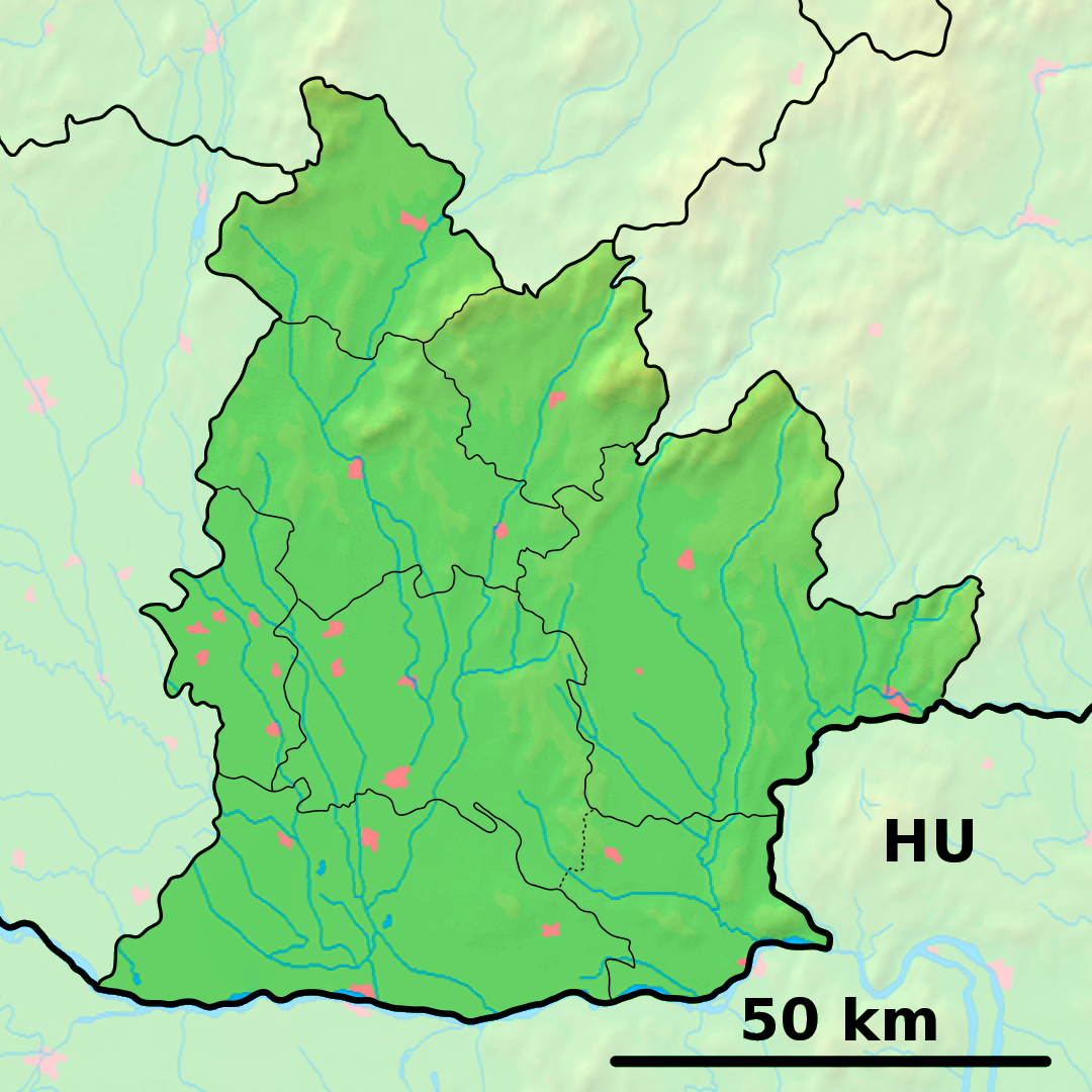
District de Šaľa — Šaľa Informations Pays … Wikipédia en Français
Androgen insensitivity syndrome — Classification and external resources AIS results when the function of the androgen receptor (AR) is impaired. The AR protein (pictured) mediates the effects of androgens in the human body. ICD 10 E … Wikipedia
Váh — Geobox | River name = Váh other name = category = image caption = The Váh near Piešťany. etymology = nickname = country = Slovakia country state = region = district = commune = municipality = parent = tributary left = tributary right = city =… … Wikipedia
Nitra Region — Coordinates: 48°18′25″N 18°05′11″E / 48.30694°N 18.08639°E / 48.30694; 18.08639 … Wikipedia
Šaľa District — Infobox Slovak district subject name = Šaľa District region district slovak region = Nitra Region population = 54,000 (2001) prefix = 31 area = 356 car plate = SA image location = Okres sala.png Šaľa District ( okres Šaľa ) is a district in the… … Wikipedia
 Slovaquie
 Selice