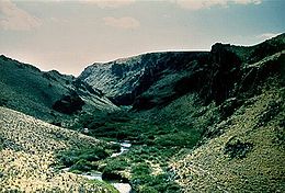
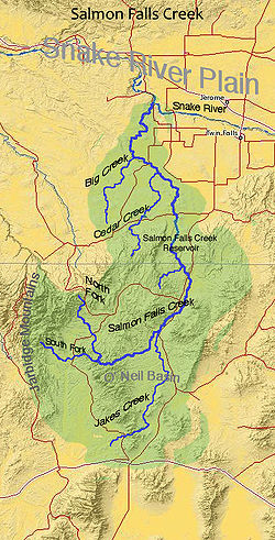
Salmon Falls Creek
Contenu soumis à la licence CC-BY-SA. Source : Article Salmon Falls Creek de Wikipédia en français (auteurs)
Regardez d'autres dictionnaires:
Salmon Falls Creek — Sp Lašišų Krioklių ùpė Ap Salmon Falls Creek L JAV (Aidahas) … Pasaulio vietovardžiai. Internetinė duomenų bazė
Salmon Falls, California — OverviewSalmon Falls, California was an old mining town established along the banks of the American River at the mouth of Sweetwater Creek (northeast of present day Folsom, California). After the building of Folsom Dam in the 1950 s, Salmon Falls … Wikipedia
Rivière Salmon (Idaho) — Pour les articles homonymes, voir Salmon. Rivière Salmon (Salmon river) Au nord de Riggins … Wikipédia en Français
White Salmon (rivière) — 46°9′43.1″N 121°37′33.6″O / 46.161972, 121.626 … Wikipédia en Français
Latah Creek — (Hangman Creek) Latah Creek en hiver, 2005 Caractéristiques Longueur 97 km Bassin 1 743 km2 … Wikipédia en Français
Crab Creek — Caractéristiques Longueur 262 km Bassin 13 200 km2 … Wikipédia en Français
Salmon — is the common name for several species of fish of the family Salmonidae. Several other fish in the family are called trout. Salmon live in both the Atlantic and Pacific Oceans, as well as the Great Lakes and other land locked lakes.Typically,… … Wikipedia
Salmon River (Clackamas County, Oregon) — [ Wildwood Recreation Site, less than two miles (3 km) before its mouth.] The Salmon River is a 33.9 mile (55 km) river in Oregon s Cascade Range and drains a portion of southwestern Mount Hood.The entire length of the river is protected National … Wikipedia
Salmon River (Idaho) — Coordinates: 45°51′23″N 116°47′37″W / 45.85639°N 116.79361°W / 45.85639; 116.79361 … Wikipedia
Salmon Creek Falls — Infobox Waterfall name = Salmon Creek Falls image size = 100 caption = Salmon Creek Falls, California location = Near Gorda in Los Padres National Forest, Monterey County, California, USA elevation = 300 feet (91.4 meters) type = Segmented height … Wikipedia


