Rovca
- Rovca
-
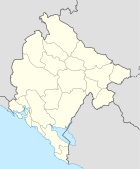
Rovca (en serbe cyrillique : Ровца) est un village du nord-est du Monténégro, dans la municipalité de Berane.
Démographie
Évolution historique de la population
Évolution démographique
(Source : [1])
| 1948 |
1953 |
1961 |
1971 |
1981 |
1991 |
2003 |
| 244 |
251 |
246 |
222 |
194 |
110 |
105 |
Pyramide des âges (2003)
| Pyramide des âges de la ville de Rovca |
Pyramide des âges de la ville de Rovca en 2003 (population totale : 105)[2] :
| Hommes |
Classe d'âge |
Femmes |
|
3
|
? |
1
|
|
3
|
80 et plus |
0
|
|
1
|
75-79 |
2
|
|
4
|
70-74 |
1
|
|
3
|
65-69 |
4
|
|
2
|
60-64 |
3
|
|
5
|
55-59 |
1
|
|
2
|
50-54 |
5
|
|
2
|
45-49 |
2
|
|
3
|
40-44 |
3
|
|
5
|
35-39 |
3
|
|
7
|
30-34 |
2
|
|
4
|
25-29 |
0
|
|
2
|
20-24 |
7
|
|
4
|
15-19 |
4
|
|
3
|
10-14 |
4
|
|
2
|
5-9 |
3
|
|
3
|
0-4 |
3
|
|
Répartition de la population par nationalités (2003)
Source[3]
| Répartition de la population par nationalités |
Nombre |
% |
| Serbes |
49 |
46,66 |
| Monténégrins |
43 |
40,95 |
| Inconnus/Autres |
13 |
12,38 |
Notes et références
- ↑ (sr) Књига 9, Становништво, упоредни преглед броја становника 1948, 1953, 1961, 1971, 1981, 1991, 2003, подаци по насељима, Републички завод за статистику, Подгорица, септембар 2005, COBISS-ID 8764176
- ↑ (sr) Књига 2, Становништво, пол и старост, подаци по насељима, Републички завод за статистику, Подгорица, октобар 2004, COBISS.CG-ID 8489488
- ↑ (sr) Књига 1, Становништво, национална или етничка припадност, подаци по насељима, Републички завод за статистику, Подгорица, септембар 2004, ISBN 86-84433-00-9
Catégories :
- Village du Monténégro
- Localité de Berane
Wikimedia Foundation.
2010.
Contenu soumis à la licence CC-BY-SA. Source : Article Rovca de Wikipédia en français (auteurs)
Regardez d'autres dictionnaires:
Gornja Rovca Bulatovići — Ajouter une image Administration Nom cyrillique Горња Ровца Булатовићи Pays Montenegro … Wikipédia en Français
mərovca — is. bot. Yarpaqları topaşəkilli yeməli yabanı ot bitkisi. Ballı, bacısı oğlu ilə birlikdə kəndin üst tərəfindəki güneylərə gedər, . . mərovca yığardı. Ə. Vəl.. Yusifin . . mal otardığı yaz vaxtı kolların dibindən mərovca, quluncar . . dərdiyi… … Azərbaycan dilinin izahlı lüğəti
List of places in Montenegro — This is a list of all census designated places in Montenegro, sorted by municipalities. Places with more than 1000 residents are in italic .Andrijevica*Andrijevica *Andželati *Bojovići *Božići *Cecuni *Đulići *Dulipolje *Gnjili Potok *Gornje Luge … Wikipedia
Berane — Vue de Berane Administration Nom cyrillique Беране Pays … Wikipédia en Français
Kolašin — Vue de Kolašin Administration Nom cyrillique Колашин Pays … Wikipédia en Français
Kolašin — Infobox Montenegro city name=Kolašin city name cyr=Колашин mayor=Mileta Bulatović (SNP NS) area=897 population=2,989 municipality=9,949 Time zone=UTC+1 founded=17th century latitude=42.82 longitude=19.52 area code=20 car plates=KL postal=81210… … Wikipedia
Biogradska Gora — Infobox protected area | name = Biogradska Gora National Park iucn category = II caption = locator x = locator y = location = Montenegro nearest city = lat degrees = 42 lat minutes = 53 lat seconds = 53 lat direction = N long degrees = 19 long… … Wikipedia
Geographical regions in Montenegro — This is a list of some of Geographical regions in Montenegro. These regions have no official status, and some of them do overlap, or could not be said to have clear borders.Geographical regions in Montenegro* Montenegrin Littoral ** Gulf of Kotor … Wikipedia
Drobnjaci — Ethnicity Serb[1][2] (Montenegrin Serb) … Wikipedia
Biogradska Gora — Nationalpark Biogradska Gora … Deutsch Wikipedia
 Monténégro