Ross of Mull
- Ross of Mull
-
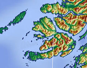
Le Ross of Mull est la plus grande péninsule de l'île de Mull en Écosse. S'avançant dans l'océan Atlantique sur 28 kilomètres en direction de l'ouest, elle forme la partie méridionale de Mull. Dans sa partie orientale, le Ross of Mull est délimité au nord par le loch Scridain et au sud par le Firth of Lorn. Dans son prolongement se trouve l'île d'Iona accompagnée de plusieurs petits îlots.
Wikimedia Foundation.
2010.
Contenu soumis à la licence CC-BY-SA. Source : Article Ross of Mull de Wikipédia en français (auteurs)
Regardez d'autres dictionnaires:
Ross of Mull — The Ross of Mull is the largest peninsula of the Isle of Mull, about 28 km long, and making up the south western part of the island. It is bounded to the north by Loch Scridain and by the Firth of Lorne to the south. The main settlements are… … Wikipedia
Ross of Mull — Sp Mãlo kyšulỹs Ap Ross of Mull angliškai Ap An Ros Muileach geliškai (škotiškai) L Hebriduose (Malo s.), Jungtinė Karalystė, D. Britanija (Škotija) … Pasaulio vietovardžiai. Internetinė duomenų bazė
Ross of Mull — Sp Mãlo kyšulỹs Ap Ross of Mull angliškai Ap An Ros Muileach geliškai (škotiškai) L Hebriduose (Malo s.), D. Britanija (Škotija) … Pasaulio vietovardžiai. Internetinė duomenų bazė
Mull, Isle — MULL, ISLE of, in the district of Mull, county of Argyll; containing 10,064 inhabitants. This forms one of the Hebrides, or Western Islands, of which it ranks as the third in extent. It originally constituted part of the dominions of the… … A Topographical dictionary of Scotland
Mull Little Theatre — began as the Thursday Theatre, an entertainment for the paying guests of the Druimard Guest House on the Isle of Mull in the Inner Scottish Hebrides. Built from the shell of an old byre (cowshed) in 1963 by Barrie and Marianne Hesketh, it grew in … Wikipedia
Mull Historical and Archaeological Society — For the musical artist with a similar name, see Mull Historical Society. Mull Historical Archaeological Society were originally called simply Mull Historical Society but changed their name to underline the importance of archaeology in their work… … Wikipedia
Isle of Mull — Mull redirects here. For other uses, see Mull (disambiguation). Isle of Mull Location OS grid reference … Wikipedia
Isla de Mull — Para otros usos de este término, véase Mull. Isla de Mull Muile Entrada al Loch Feochan, en Mull … Wikipedia Español
Ulva (Mull) — Pour les articles homonymes, voir Ulva. Ulva Géographie Pays … Wikipédia en Français
Île de Mull — Pour les articles homonymes, voir Mull. Île de Mull Isle of Mull (en) Géographie Pays … Wikipédia en Français
 Royaume-Uni


 Portail de l’Écosse
 Portail du monde maritime
