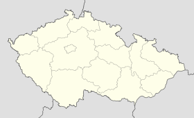
Rohovládova Bělá
Contenu soumis à la licence CC-BY-SA. Source : Article Rohovládova Bělá de Wikipédia en français (auteurs)
Regardez d'autres dictionnaires:
Rohovládova Bělá — Geobox | Settlement name = Rohovládova Bělá other name = category = Village image caption = symbol = etymology = official name = motto = nickname = country = Czech Republic country state = region = Pardubice region type = Region district =… … Wikipedia
Liste deutscher Bezeichnungen tschechischer Orte — In dieser Liste werden deutschen (heute großteils nicht mehr geläufigen) topografischen Namen die tschechischen, amtlichen Pendants gegenübergestellt. Durch die Vertreibungen nach 1945 wurden viele kleinere Orte und Gehöfte, insbesondere in… … Deutsch Wikipedia
List of German exonyms for places in the Czech Republic — Below are links to subpages with more detailed listings of the German language names of towns and villages in different regions of the Czech Republic. Many of these German names are now exonyms, but used to be endonyms commonly used by the local… … Wikipedia
Neratau — Dieser Artikel beschreibt die Gemeinde Neratov. Für die gleichnamige Ortschaft, siehe Neratov v Orlických horách. Neratov … Deutsch Wikipedia
Neratov — Neratov … Deutsch Wikipedia
District de Pardubice — Okres Pardubice (cs) Administration … Wikipédia en Français
Chvaletice — Coordinates: 50°2′3″N 15°25′0″E / 50.03417°N 15.416667°E / 50.03417; 15.416667 … Wikipedia
Pardubice District — ( cs. Okres Pardubice) is a district ( okres ) within the Pardubice Region ( Pardubický kraj ) of the Czech Republic. Its capital is the city of Pardubice.OverviewWith 888.98 km² and around 160,000 inhabitants Pardubice District is the smallest… … Wikipedia
Choltice (Pardubice District) — See other places named Choltice. Coordinates: 49°59′22″N 15°37′4″E / 49.98944°N 15.61778°E / 49.98944; 15 … Wikipedia
Bad Bochdanetsch — Lázně Bohdaneč … Deutsch Wikipedia
 République tchèque
