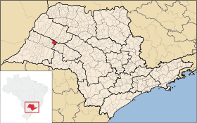
Rinópolis
Contenu soumis à la licence CC-BY-SA. Source : Article Rinópolis de Wikipédia en français (auteurs)
Regardez d'autres dictionnaires:
Rinópolis — is a municipality in the state of São Paulo in Brazil. The population in 2004 was 9,786 and the area is 359.57 km². The elevation is 425 m … Wikipedia
Rinopolis — Admin ASC 2 Code Orig. name Rinópolis Country and Admin Code BR.27.3543808 BR … World countries Adminstrative division ASC I-II
Municipios de São Paulo — Contenido 1 Mesoregiones y Microregiones 1.1 Mesorregión de Araçatuba 1.1.1 Microrregión de Andradina 1.1.2 Microrregión de Araçatuba … Wikipedia Español
Муниципалитеты штата Сан-Паулу — … Википедия
Ринополис — Муниципалитет Ринополис Rinópolis Герб … Википедия
List of municipalities in São Paulo — Municipalities of São Paulo This is a list of the municipalities in the state of São Paulo (SP), Brazil. Mesoregion Microregion Municipality Araçatuba Andradina Andradina … Wikipedia
Dracena — For other uses, see Dracena (disambiguation). Coordinates: 21°28′57″S 51°31′58″W / 21.4825°S 51.53278°W / 21.4825; 51.53278 … Wikipedia
Monte Castelo, São Paulo — Coordinates: 21°17′58″S 51°34′07″W / 21.29944°S 51.56861°W / 21.29944; 51.56861 Monte Castelo is a municipality i … Wikipedia
Nova Guataporanga — Coordinates: 21°21′04″S 31°38′38″W / 21.35111°S 31.64389°W / 21.35111; 31.64389 Nova Guataporanga is a municipality in the st … Wikipedia
Ouro Verde — Coordinates: 21°29′22″S 51°42′01″W / 21.48944°S 51.70028°W / 21.48944; 51.70028 Ouro Verde (meaning green gold) is a municipality/co … Wikipedia

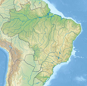
 Brésil
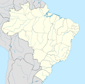
 São Paulo