Richnava
- Richnava
-
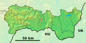
Richnava(allemand : Reichenau in der Zips) est un village de Slovaquie situé dans la région de Košice.
Histoire
Première mention écrite du village en 1346.
Notes et références
Catégories : - Village de Slovaquie
- Village et ville du district de Gelnica
Wikimedia Foundation.
2010.
Contenu soumis à la licence CC-BY-SA. Source : Article Richnava de Wikipédia en français (auteurs)
Regardez d'autres dictionnaires:
Richnava — Wappen Karte … Deutsch Wikipedia
Richnava — is a village and municipality in the Gelnica District in the Košice Region of eastern Slovakia … Wikipedia
Richňava — is one of the lakes near Banská Štiavnica in Slovakia. These lakes (or tajchy as locals call them) were created as water reservoirs for the mining industry … Wikipedia
Richnava (district Gelnica) — Richnava Administration Pays Slovaquie … Wikipédia en Français
Richnava (okres Gelnica) — Richnava (district Gelnica) Richnava Administration Pays Slovaquie … Wikipédia en Français
Penzion Richnava — (Банска Штьявница,Словакия) Категория отеля: 2 звездочный отель Адрес: Stiavnicke B … Каталог отелей
Tajchy — (singular: tajch) are artificial water reservoirs in the Štiavnica Mountains, in central Slovakia. Most of them were built in order to provide energy for the silver mines of Banská Štiavnica in the 18th century. At their height, tajchy comprised… … Wikipedia
Tajchy — Ciudad histórica de Banská Štiavnica y monumentos técnicos de los alrededores1 Patrimonio de la Humanidad Unesco Plaza de la Trinidad … Wikipedia Español
District de Gelnica — Gelnica Informations Pays … Wikipédia en Français
Košice Region — Geobox | Region name = Košice other name = category = Region image caption = image caption = symbol = symbol type = Coat of arms etymology = official name = motto = nickname = country = Slovakia country state = region = district = commune =… … Wikipedia
 Slovaquie


