Predmier
- Predmier
-
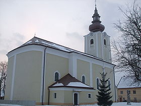
Predmier est un village de Slovaquie situé dans la région de Žilina.
Histoire
Première mention écrite du village en 1193.
Notes et références
Catégories :
- Village de Slovaquie
- Village et ville du district de Bytča
Wikimedia Foundation.
2010.
Contenu soumis à la licence CC-BY-SA. Source : Article Predmier de Wikipédia en français (auteurs)
Regardez d'autres dictionnaires:
Predmier — Geobox | Settlement name = Predmier other name = category = Village image caption = symbol = etymology = official name = motto = nickname = country = Slovakia country state = region = Žilina district = Bytča commune = municipality = part = river … Wikipedia
Žilina Region — Geobox | Region name = Žilina other name = category = Region image caption = symbol = CoA Žilina Region Slovakia.png symbol type = Coat of arms etymology = official name = motto = nickname = country = Slovakia country state = region = district =… … Wikipedia
Jozef Ignác Bajza — Infobox Person name = Jozef Ignác Bajza image size = caption = birth name = birth date = 5 March 1755 birth place = Predmier, Habsburg Monarchy (now Slovakia) death date = 1 December 1836 (aged 81) death place = Bratislava, Habsburg Monarchy (now … Wikipedia
D1 (Slowakei) — Vorlage:Infobox hochrangige Straße/Wartung/SK D Diaľnica D1 in der Slowakei … Deutsch Wikipedia
Súľov-Hradná — Wappen Karte … Deutsch Wikipedia
Autoroute slovaque D1 — | Autoroute slovaque D1 Longueur : 511 km … Wikipédia en Français
Bytča — Coordinates: 49°13′27″N 18°33′51″E / 49.22417°N 18.56417°E / 49.22417; 18.56417 … Wikipedia
Bytča District — Infobox Slovak district subject name = Bytča District region district slovak region = Žilina Region population = 30,879 (2005) prefix = 41 area = 282 car plate = BY image location = Okres bytca.png Bytča District ( okres Bytča ) is a district… … Wikipedia
List of municipalities and towns in Slovakia — Slovakia This is a comprehensive list of municipalities and towns in Slovakia. For lists of towns and municipalities sorted by Regions see the individual articles on Regions. For an outdated list of towns only in Slovakia see also List of towns… … Wikipedia
Maršová-Rašov — Location of Bytča District in the Žilina Region Maršová Rašov is a village and municipality in Bytča District in the Žilina Region of northern Slovakia. History In historical records the village was fir … Wikipedia
 Slovaquie
 Predmier